Rehlingen-Siersburg | |
|---|---|
 Coat of arms | |
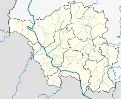
Location of Rehlingen-Siersburg within Saarlouis district  | |
 Rehlingen-Siersburg  Rehlingen-Siersburg | |
| Coordinates: 49°22′7″N 6°40′43″E / 49.36861°N 6.67861°E | |
| Country | Germany |
| State | Saarland |
| District | Saarlouis |
| Subdivisions | 10 |
| Government | |
| • Mayor (2021–31) | Joshua Pawlak[1] (SPD) |
| Area | |
| • Total | 61.16 km2 (23.61 sq mi) |
| Elevation | 193 m (633 ft) |
| Population (2021-12-31)[2] | |
| • Total | 14,343 |
| • Density | 230/km2 (610/sq mi) |
| Time zone | UTC+01:00 (CET) |
| • Summer (DST) | UTC+02:00 (CEST) |
| Postal codes | 66780 |
| Dialling codes | 06835, 06869, 06833, 06861 |
| Vehicle registration | SLS |
| Website | www |
Rehlingen-Siersburg is a municipality in the district of Saarlouis, in Saarland, Germany. It is situated on the river Saar, approx. 8 km northwest of Saarlouis, and 30 km northwest of Saarbrücken.
Geography
Location
Rehlingen is located at the Saar, Siersburg is located at the Nied, the other districts are partly on the Gau (Saargau), partly in the valley of the Nied, a left-side tributary of the Saar. Rehlingen-Siersburg borders France to the west, Merzig-Wadern district to the north, Dillingen / Saar to the east, and Wallerfangen to the south.
Municipal districts
- Biringen
- Eimersdorf
- Fremersdorf
- Fürweiler
- Gerlfangen
- Hemmersdorf
- Niedaltdorf
- Oberesch
- Rehlingen Siersburg
Sights
- Castle Fremersdorf
- Castle Siersburg
- Niedaltdorf stalactite cave
- Lorraine houses and castles in different districts
- Niedtal
- Saargau
- Druids path
References
- ↑ Gewählte Ober-/Bürgermeister*innen, Landrät*innen und Regionalverbandsdirektor*in im Saarland, Statistisches Amt des Saarlandes, 27 March 2022.
- ↑ "Amtliche Einwohnerzahlen Stand 31. Dezember 2021" (PDF) (in German). Statistisches Amt des Saarlandes. June 2022.
Wikimedia Commons has media related to Rehlingen-Siersburg.
This article is issued from Wikipedia. The text is licensed under Creative Commons - Attribution - Sharealike. Additional terms may apply for the media files.