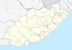
Quigney | |
|---|---|
 Quigney  Quigney | |
| Coordinates: 33°00′58″S 27°54′54″E / 33.016°S 27.915°E | |
| Country | South Africa |
| Province | Eastern Cape |
| Municipality | Buffalo City |
| Main Place | East London |
| Area | |
| • Total | 2.01 km2 (0.78 sq mi) |
| Population (2011)[1] | |
| • Total | 11,258 |
| • Density | 5,600/km2 (15,000/sq mi) |
| Racial makeup (2011) | |
| • Black African | 75.3% |
| • Coloured | 5.3% |
| • Indian/Asian | 3.0% |
| • White | 15.2% |
| • Other | 1.2% |
| First languages (2011) | |
| • Xhosa | 54.1% |
| • English | 26.2% |
| • Afrikaans | 10.0% |
| • Southern Ndebele | 1.2% |
| • Other | 8.5% |
| Time zone | UTC+2 (SAST) |
| Postal code (street) | 5201 |
| PO box | 5211 |
Quigney is a suburb of East London in South Africa.
It got its name from the "Gwygney River" according to the earliest maps of East London from September 1847 by William Jervois. The municipality started to sell plots "east of the Quigney River" after 1883.[2]
References
- 1 2 3 4 "Sub Place Quigney". Census 2011.
- ↑ "The Quigney". www.knowledge4africa.co.za. Archived from the original on 26 August 2007. Retrieved 12 January 2022.
This article is issued from Wikipedia. The text is licensed under Creative Commons - Attribution - Sharealike. Additional terms may apply for the media files.
.svg.png.webp)