.JPG.webp) Prickly Pear island | |
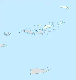
 Prickly Pear The location of Prickly Pear within the British Virgin Islands  Prickly Pear Prickly Pear (Caribbean) | |
| Geography | |
|---|---|
| Location | Caribbean Sea |
| Coordinates | 18°30′N 64°22′W / 18.500°N 64.367°W |
| Archipelago | Virgin Islands |
| Administration | |
United Kingdom | |
| British Overseas Territory | British Virgin Islands |
| Additional information | |
| Time zone | |
| ISO code | VG |
Prickly Pear is an uninhabited island of the British Virgin Islands in the Caribbean. Even though the island doesn't have permanent residents, it has a beach bar and recreational water sports facility on it. It is located on the north side of North Sound, opposite Virgin Gorda.
The island was declared to be a National Park in 1988.[1]
The island provides habitat for the common Puerto Rican ameiva (Ameiva exsul), crested anole (Anolis cristatellus wileyae), barred anole (Anolis stratulus), and the big-scaled least gecko (Sphaerodactylus macrolepis macrolepis).[2] The island's flora includes agave (Agave missionum), and copperwood (Bursera simarouba).[3]
References
- ↑ "Prickly Pear National Park". BVI Tourism. Archived from the original on 1 November 2014. Retrieved 1 November 2014.
- ↑ Heatwole, Harold; Levins, Richard; Byer, Michael D. (July 1981). Atoll research bulletin - Biogeography of the Puerto Rican bank. Vol. 251. Washington D.C.: The Smithsonian Institution. pp. 50. OCLC 45726059.
- ↑ Heatwole, Harold; Levins, Richard; Byer, Michael D. (July 1981). Atoll research bulletin - Biogeography of the Puerto Rican bank. Vol. 251. Washington D.C.: The Smithsonian Institution. pp. 28. OCLC 45726059.
This article is issued from Wikipedia. The text is licensed under Creative Commons - Attribution - Sharealike. Additional terms may apply for the media files.