Pradhan Khunta | |
|---|---|
Village | |
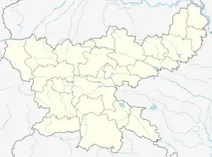
 Pradhan Khunta Location in Jharkhand, India  Pradhan Khunta Pradhan Khunta (India) | |
| Coordinates: 23°45′57″N 86°31′23″E / 23.765833°N 86.523067°E | |
| Country | |
| State | Jharkhand |
| District | Dhanbad |
| Population (2011) | |
| • Total | 4,399 |
| Languages | |
| • Official | Hindi, Urdu, Kudmali |
| Time zone | UTC+5:30 (IST) |
| Telephone/ STD code | 0326 |
| Website | dhanbad |
Pradhan Khunta is a village in Baliapur CD Block in Dhanbad subdivision of Dhanbad district in the Indian state of Jharkhand.
Geography
The Dhangi Hills (highest peak 385.57 m) run from Pradhan Khunta to Gobindpur.[1][2]
Demographics
As per the 2011 Census of India, Pradhan Khunta had a total population of 4,399 of which 2,274 (52%) were males and 2,125 (48%) were females. Population below 6 years was 587. The total number of literates in Pradhan Khunta was 2,930 (76.86% of the population over 6 years).[3]
Transport
The Asansol-Gaya section, a part of the Grand Chord, passes through this block. There is a station at Pradhan Khunta on this line.[4]
Deuli-Khairpal Road passes through Pradhan Khunta and links it to NH 19, Baliapur and Sindri.[5]
References
- ↑ "Chapter III - Study Area: Dhanbad District" (PDF). Pages 38-43. Shodganga. Retrieved 8 October 2017.
- ↑ "gztr 2.Chapter I (General) 1-38" (PDF). Pages 2-5. Jharkhand Government. Retrieved 8 October 2017.
- ↑ "2011 Census C.D. Block Wise Primary Census Abstract Data(PCA)". Jharkhand – District-wise CD Blocks. Registrar General and Census Commissioner, India. Retrieved 15 October 2017.
- ↑ "13305 Dhanbad-Gaya Inter-City Express". Time Table. Indiarailinfo. Retrieved 8 October 2017.
- ↑ Google maps
This article is issued from Wikipedia. The text is licensed under Creative Commons - Attribution - Sharealike. Additional terms may apply for the media files.
