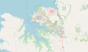
| Pinelands Palmerston, Northern Territory | |||||||||||||||
|---|---|---|---|---|---|---|---|---|---|---|---|---|---|---|---|
 McKinnon Road, Pinelands | |||||||||||||||
 Pinelands | |||||||||||||||
| Coordinates | 12°27′22″S 130°57′33″E / 12.456239°S 130.959199°E[1] | ||||||||||||||
| Population | 25 (2016 census)[2] | ||||||||||||||
| Established | 5 December 2001[1] | ||||||||||||||
| Postcode(s) | 0829[3] | ||||||||||||||
| Location |
| ||||||||||||||
| LGA(s) | City of Palmerston[1] | ||||||||||||||
| Territory electorate(s) | Drysdale | ||||||||||||||
| Federal division(s) | Solomon | ||||||||||||||
| |||||||||||||||
| Footnotes | Adjoining suburbs[4][5] | ||||||||||||||
Pinelands is an outer northern suburb of Palmerston, Northern Territory, Australia. It is 21 km southeast of the Darwin CBD and 2.1 km from Palmerston City. Its local government area is the City of Palmerston.
The area is one of Palmerston's industrial suburbs, along with Yarrawonga.
References
- 1 2 3 "Place Names Place Names Register Extract for "Pinelands" (Suburb)". NT Place Names Register. Northern Territory Government. Retrieved 10 June 2019.
- ↑ Australian Bureau of Statistics (27 June 2017). "Pinelands (State Suburb)". 2016 Census QuickStats. Retrieved 28 June 2017.
- ↑ "Pinelands Postcode". postcode-finders.com.au. Archived from the original on 15 May 2019. Retrieved 10 June 2019.
- ↑ "Search result for 'Pinelands'". NT Atlas and Spatial Data Directory. Northern Territory Government. Retrieved 10 June 2019.
- ↑ "Palmerston City Council Suburbs" (PDF). Place Names Committee. Northern Territory Government. Archived from the original (PDF) on 18 March 2019. Retrieved 10 June 2019.
This article is issued from Wikipedia. The text is licensed under Creative Commons - Attribution - Sharealike. Additional terms may apply for the media files.