Pilcaya
Pilcacyan | |
|---|---|
| Nickname: Pilcaya la bella | |
| Motto: Pilcaya Cambia | |
 Pilcaya  Pilcaya | |
| Coordinates: 18°42′N 99°30′W / 18.700°N 99.500°W | |
| Country | |
| State | Guerrero |
| Municipal seat | Pilcaya |
| Government | |
| • Municipal Mayor | Mardonio Reyna Castañeda (PRD) |
| Area | |
| • Total | 62.1 km2 (24.0 sq mi) |
| Population (2005) | |
| • Total | 11,035 |
| Time zone | UTC-6 (Central) |
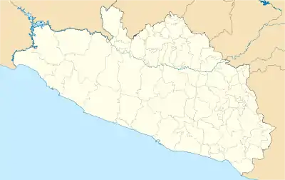
Pilcaya is one of the 81 municipalities of Guerrero, in south-western Mexico. The municipal seat lies at Pilcaya. The municipality covers an area of 62.1 km².
Pilcaya is located 153 kilometers from Mexico City, 105 from Cuernavaca, 84 from Toluca, 68 from Taxco and 5 from Ixtapan de la Sal. Pilcaya, of Náhuatl origin, is from the Náhuatl word pilcacyan, place of a hanging object.[1]
The Town
Pilcaya is mainly an agricultural town whose main activity is the cultivation of gladiola flowers which growers sell in nearby Tenancingo and Mexico City. There is also a recent surge in the building of greenhouses which mainly grow tomatoes for sale in Mexico City and the local market.
Landmarks in Pilcaya
Sanctuary of La Imaculada Concepcion, whose construction was initiated in 1650 and is still in use. Parque Nacional Grutas de Cacahuamilpa
The Municipality
As municipal seat, Pilcaya has governing jurisdiction over the following communities:La Concepcion, Cacahuamilpa, El Mogote, El Sauz, Crucero de Grutas, El Platanar, Juchimilpa, El Bosque, Nombre de Dios, Los Sauces, Santa Maria, Chimaltitlan, Amatitlan, Cuitlapa, El Uvalar, Tecuanipa, Chichila, Piedras Negras, El Transformador, and Santa Teresa. The population of the municipality of Pilcaya is 10,050 as of 2005. The municipality of Pilcaya is the only municipality in Guerrero to border both the state of Mexico and the state of Morelos. It borders the municipio of Ixtapan, Tonatico, Coatepec Harinas and Zacualpan in the state of Mexico to the north and west. To the east it borders Coatlan del Rio in the state of Morelos. And to the south it borders Taxco and Tetipac both in the state of Guerrero.
As of 2005, the municipality had a total population of 11,035.[2]
References
- ↑ "Home". pilcaya.gob.mx.
- ↑ "Pilcaya". Enciclopedia de los Municipios de México. Instituto Nacional para el Federalismo y el Desarrollo Municipal. Archived from the original on May 26, 2007. Retrieved December 23, 2008.