| Petticoat Creek | |
|---|---|
 Mouth of Petticoat Creek. | |
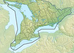
 Location of the mouth of Petticoat Creek in Southern Ontario | |
| Location | |
| Country | Canada |
| Province | Ontario |
| Region | Greater Toronto Area |
| Municipalities | |
| Physical characteristics | |
| Source | Confluence of two unnamed streams |
| • location | Markham |
| • coordinates | 43°52′45″N 79°11′22″W / 43.87922394143364°N 79.18946912657846°W |
| • elevation | 195 m (640 ft) |
| Mouth | Lake Ontario |
• location | Pickering |
• coordinates | 43°48′15″N 79°06′15″W / 43.80417°N 79.10417°W[1] |
• elevation | 74 m (243 ft) |
| Basin size | 26.77 km2 (10.34 sq mi) |
| Basin features | |
| River system | Great Lakes Basin |
Petticoat Creek is a stream in the cities of Pickering, Toronto and Markham in the Greater Toronto Area of Ontario, Canada.[1][2] The creek is in the Great Lakes Basin, is a tributary of Lake Ontario, and falls under the auspices of the Toronto and Region Conservation Authority. Its watershed covers 26.77 square kilometres (10.34 sq mi), and the cumulative length of all its branches is 49 kilometres (30 mi). Land use in the watershed consists of 52% agricultural, 27% protected greenspace and 21% urban.[3]
The "Petticoat Creek watershed is dominated by the South Slope physiographic region, a smooth, faintly drumlinized till plain."[4]
Because the creek is not long enough for its headwaters to lie within the groundwater rich Oak Ridges Moraine, waterflow on the upper reaches is intermittent and dependent on precipitation. Lower reaches, below the ancient shoreline of glacial Lake Iroquois, is more consistent.
Petticoat Creek Conservation Area
The Petticoat Creek Conservation Area is located at the mouth of the creek at Lake Ontario,[5] and is managed by the Toronto and Region Conservation Authority after the Petticoat Creek Conservation Authority was absorbed in the TRCA.
See also
References
Footnotes
- 1 2 "Petticoat Creek". Geographical Names Data Base. Natural Resources Canada. Retrieved 2018-07-03. (creek)
- ↑ TRCA Watershed Action Plan, 2012, 2.1 Watershed Perspective, p. 10. "Today, Petticoat Creek watershed represents a continuum between natural, rural and urban land uses and is best described as an urbanizing, warm-water nude system. Natural and rural areas of the watershed, comprising roughly two-thirds of the land base, are protected under selected provincial initiatives, explained below. The long history of agriculture in this area has not resulted in significant degradation of the northern portion of the watershed. The agricultural community has generally been a good steward of this land."
- ↑ "Petticoat Creek". Toronto and Region Conservation Authority. 2013. Archived from the original on 2014-06-29. Retrieved 2018-07-03.
- ↑ TRCA Watershed Action Plan, 2012, 2.8 Terrestrial System, p. 37. "Historically, the watershed would have been predominantly covered in forest and wetlands. Over time this natural cover, along with its environmental benefits, was diminished by human activity to what is now considered below the desired level. Today, natural cover in the form of forests, wetlands, and meadows is concentrated in public greenspace areas:"
- ↑ "Petticoat Creek Conservation Area". Geographical Names Data Base. Natural Resources Canada. Retrieved 2018-07-03. (conservation area)
Bibliography
- "Watershed Action Plan" (PDF). Toronto and Region Conservation Authority. August 2012. Retrieved 2018-07-03.
External links
- Petticoat Creek Conservation Area
- Petticoat Creek Watershed Report Card 2018 (Toronto and Region Conservation Authority)
- Upper Petticoat Creek Terrestrial Biological Inventory and Assessment 2015 (Toronto and Region Conservation Authority)