| Payette Lake | |
|---|---|
Panoramic view of southern shore in McCall | |
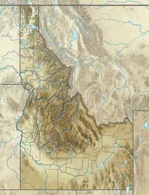
 Payette Lake Location in the United States  Payette Lake Location in Idaho | |
| Location | Valley County, Idaho, U.S. |
| Coordinates | 44°57′N 116°05′W / 44.95°N 116.09°W[1] |
| Primary inflows | North Fork Payette River |
| Primary outflows | North Fork Payette River |
| Catchment area | 144 square miles (373 km2) |
| Basin countries | United States |
| Max. length | 6 miles (9.7 km) |
| Max. width | 2.25 miles (3.62 km) |
| Surface area | 4,986.7 acres (2,018.0 ha)[2] |
| Average depth | 121 feet (36.8 m) |
| Max. depth | 304 feet (92.7 m) |
| Water volume | 0.18 cubic miles (0.75 km3) |
| Shore length1 | 22 miles (36 km) |
| Surface elevation | 4,990 feet (1,520 m)[1] |
| Settlements | McCall, Idaho |
| 1 Shore length is not a well-defined measure. | |
Payette Lake is a natural lake in the western United States, located in west central Idaho at McCall. Formed by glacial activity, it is situated in the upper drainage basin of the Payette River, which drains into the Snake River.
Outflow from the lake at its southwest corner is regulated for irrigation purposes by a small dam completed in 1943. The normal maximum lake surface elevation of 4,990 feet (1,520 m) above sea level is attained in July; a normal drawdown of 5 feet 7 inches (1.7 m) is completed by December.
The lake's surface area and volume, excluding islands, are 7.9 square miles (20.5 km2) and 0.18 cubic miles (0.75 km3), respectively; mean and maximum depths are 121 feet (36.8 m) and 304 feet (92.7 m), respectively; and shoreline length is about 22 miles (36 km).
The principal tributary and outlet is the North Fork of the Payette River. The lake receives drainage from 144 square miles (373 km2) of heavily forested, mountainous terrain.[3] Further south, the North Fork flows into Lake Cascade, the reservoir behind Cascade Dam.
History
Prior to the arrival of Euro-American hunters in the 1830s, the area had been inhabited by Native Americans for thousands of years. The discovery of gold in 1862 in the upper drainage of Payette Lake prompted an influx of miners to the area. The townsite of McCall was established on the lake's southern shore in the 1880s. The area became more accessible in 1914 when a railroad and roads were extended to McCall, which was becoming a tourist destination for summer and winter recreation. In 1920, the Idaho State Land Board began leasing vacation homesites around Payette Lake. Increasing recreational demands led to the establishment of Brundage Mountain Ski Area and Ponderosa State Park, both near McCall, in the 1960s.[3]
The large Payette Lakes Club was said to be significant in supporting recreation in the area; it was built 1914–15, on a knoll overlooking the lake from the west, and served as an inn, casino, and Chautauqua center. It was surrounded by development of many small cabin lots.[4]
In popular culture
In Idaho folklore, a sea serpent much like the Loch Ness Monster is said to live in the deep waters of Payette Lake; in 1954, the creature was given the name Sharlie.[5]

References
- 1 2 "Payette Lake". Geographic Names Information System. United States Geological Survey, United States Department of the Interior.
- ↑ "Payette Lake". Idaho Department of Fish and Game. Retrieved October 18, 2018.
- 1 2 Woods, Paul F. (1997). "Eutrophication Potential of Payette Lake" (PDF). Water-Resources Investigations Report 97-4145. U.S. Geological Survey. pp. 2–4. Retrieved October 18, 2018.
- ↑ "National Register of Historic Places Registration: Payette Lakes Club / Payette Lake Club / Payette Lakes Inn" (PDF). State of Idaho. Retrieved September 13, 2019. With accompanying pictures
- ↑ "McCall, Idaho: the Monster of Payette Lake". San Diego Reader. August 13, 2011. Retrieved October 22, 2018.
External links
- Payette Lake Idaho Department of Fish and Game
- Geologic Map of McCall (with Payette Lake bathymetry)