Oščadnica | |
|---|---|
Village | |
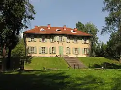
 Manor in the village | |
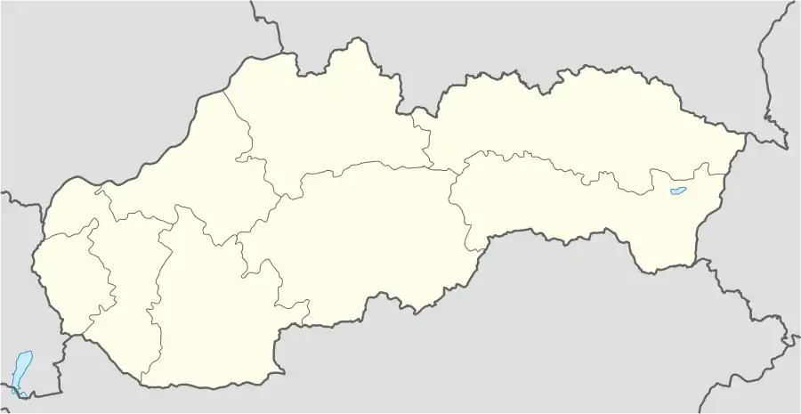
 Oščadnica Location of Oščadnica in Slovakia | |
| Coordinates: 49°26′N 18°53′E / 49.433°N 18.883°E | |
| Country | Slovakia |
| Region | Žilina |
| District | Čadca |
| First mentioned | 1579 |
| Area | |
| • Total | 58.63[1] km2 (22.64[1] sq mi) |
| Elevation | 463[2] m (1,519[2] ft) |
| Population (2021) | |
| • Total | 5,745[3] |
| Postal code | 023 01[2] |
| Area code | +421 41[2] |
| Car plate | CA |
Oščadnica (Hungarian: Ócsad) is a large village and municipality in Čadca District, in the Žilina Region of northern Slovakia. It has 22 outlying settlements. The village is now an established tourist destination, offering private lodgings and agrobusiness. During the winter a ski resort located southeast of the village, Oščadnica-Veľká Rača, is a popular destination.
Within the village are plenty of bars and restaurants serving traditional Slovak food, along with typical Western fast foods.
Location
Oščadnica lies in the northwestern part of Slovakia, below the Veľká Rača massif (1,236 m above sea level), the highest peak of the Kysucké Beskydy Mountains and the entire Kysuce region. The settlement begins in the vicinity of the confluence of the Kysuca river with the Oščadnica river and continues along it through a relatively narrow valley 13 km long. The Žilina - Čadca road and the Žilina - Český Těšín railway line lead through the western edge of the Kysuce valley, providing connections with large cities in the vicinity.
History
Kysuce was not systematically settled until the 17th century, prior to which the region as a whole was inhabited quite sparsely.[4] Although the first written mention of Oščadnica dates back to 1579, seasonal mountain huts were probably present in the area by 1500, with dwellings in the valley of today's village established by 1600. The territory initially belonged to the Budatín estate, and later to the Strečno estate. A census from 1658 states that Oščadnica was one of the larger villages, with a sawmill and a grain mill already operating there. The local population subsisted mainly on cattle and sheep breeding, lumbering, shingle production, and flax cultivation.[5] In 1720 the village had three mills, and by 1828, nearly 3,000 inhabitants. In 1804 a Baroque-classicist style church was built on the site of a wooden church from 1788.[6]
Isolated geographically, Kysuce was historically one of the poorer areas of the Kingdom of Hungary. As in the surrounding villages, an economic stimulus for Oščadnica was the extension of the Košice-Bohumín Railway in 1871. The railway helped to facilitate the transport of goods and people to regional markets and economic centers. Being located along one of the arteries to industrializing Moravia and Silesia helped to position the region for future economic development.[7] However, insufficient economic opportunities relative to population growth and the Hungarian government's Magyarization policies of the late nineteenth - early twentieth centuries encouraged emigration out of the area, notably to the United States.
In the post-1989 transition to a capitalist economy, the emergence of the nearby Veľká Rača ski resort as a tourist destination has come with significant environmental impacts.[8]
Monuments
In the village there is the Church of the Assumption of the Virgin Mary (built 1804); a Calvary (built 1948); a manor house built 1910-1913 by Prussian junker Count Ballester, which since 1976 has housed an art gallery (Slovak: Kysucká galéria); and a Lourdes Cave.[9]
Geography
The municipality lies at an altitude of 474 metres and covers an area of 58.634 km2. It has a population of about 5,700 people.
References
- 1 2 "Hustota obyvateľstva - obce [om7014rr_ukaz: Rozloha (Štvorcový meter)]". www.statistics.sk (in Slovak). Statistical Office of the Slovak Republic. 31 March 2022. Retrieved 31 March 2022.
- 1 2 3 4 "Základná charakteristika". www.statistics.sk (in Slovak). Statistical Office of the Slovak Republic. 17 April 2015. Retrieved 31 March 2022.
- ↑ "Počet obyvateľov podľa pohlavia - obce (ročne)". www.statistics.sk (in Slovak). Statistical Office of the Slovak Republic. 31 March 2022. Retrieved 31 March 2022.
- ↑ https://sk.wikipedia.org/wiki/O%C5%A1%C4%8Dadnica_(okres_%C4%8Cadca) (in Slovak)
- ↑ https://www.oscadnica.sk/obec-2/historia/o-obci/ (in Slovak)
- ↑ https://www.kniznica-cadca.sk/files/Hodnoty_na_dlani_KYSUCE_manual.pdf (in Slovak)
- ↑ https://sk.wikipedia.org/wiki/O%C5%A1%C4%8Dadnica_(okres_%C4%8Cadca) (in Slovak)
- ↑ Branislav Chrenka and Vladimir Ira, "Transformation of Tourist Landscapes in Mountain Areas: Case Studies from Slovakia," Human Geographies 5:2 (2011): 13-20 http://www.gabrielsimion.net/humangeographies.org.ro/articles/52/5_2_11_2_chrenka.pdf
- ↑ https://snowparadise.sk/en/turistika/ (in Slovak)