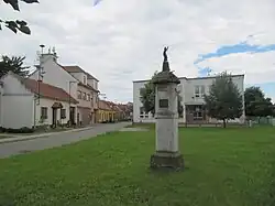
Nedakonice | |
|---|---|
 Common in Nedakonice | |
 Flag  Coat of arms | |
 Nedakonice Location in the Czech Republic | |
| Coordinates: 49°1′54″N 17°22′53″E / 49.03167°N 17.38139°E | |
| Country | |
| Region | Zlín |
| District | Uherské Hradiště |
| First mentioned | 1220 |
| Area | |
| • Total | 8.39 km2 (3.24 sq mi) |
| Elevation | 178 m (584 ft) |
| Population (2023-01-01)[1] | |
| • Total | 1,635 |
| • Density | 190/km2 (500/sq mi) |
| Time zone | UTC+1 (CET) |
| • Summer (DST) | UTC+2 (CEST) |
| Postal code | 687 38 |
| Website | www |
Nedakonice is a municipality and village in Uherské Hradiště District in the Zlín Region of the Czech Republic. It has about 1,600 inhabitants.
Geography
Nedakonice is located about 7 kilometres (4 mi) southwest of Uherské Hradiště and 29 km (18 mi) southwest of Zlín. It lies in the Lower Morava Valley. It is situated on the Dlouhá řeka Stream on the right bank of the Morava River, which forms the eastern border of the municipality.
History
The first written mention of Nedakonice is from 1220. The village was a property of the monastery in Velehrad until its abolition in 1784.[2]
References
- ↑ "Population of Municipalities – 1 January 2023". Czech Statistical Office. 2023-05-23.
- ↑ "Historie" (in Czech). Obec Nedakonice. Retrieved 2021-12-09.
External links
Wikimedia Commons has media related to Nedakonice.
This article is issued from Wikipedia. The text is licensed under Creative Commons - Attribution - Sharealike. Additional terms may apply for the media files.