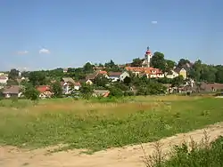
Nalžovice | |
|---|---|
 Chlum, a part of Nalžovice | |
 Flag  Coat of arms | |
 Nalžovice Location in the Czech Republic | |
| Coordinates: 49°41′55″N 14°22′15″E / 49.69861°N 14.37083°E | |
| Country | |
| Region | Central Bohemian |
| District | Příbram |
| First mentioned | 1364 |
| Area | |
| • Total | 15.63 km2 (6.03 sq mi) |
| Elevation | 340 m (1,120 ft) |
| Population (2023-01-01)[1] | |
| • Total | 618 |
| • Density | 40/km2 (100/sq mi) |
| Time zone | UTC+1 (CET) |
| • Summer (DST) | UTC+2 (CEST) |
| Postal code | 262 93, 264 01 |
| Website | www |
Nalžovice is a municipality and village in Příbram District in the Central Bohemian Region of the Czech Republic. It has about 600 inhabitants.
Administrative parts
Villages of Chlum, Hluboká, Nalžovické Podhájí, Nová Ves and Oboz are administrative parts of Nalžovice.
Geography
Nalžovice is located about 25 kilometres (16 mi) east of Příbram and 35 km (22 mi) south of Prague. It lies in the Benešov Uplands. The highest point is the hill Drbákov at 490 m (1,610 ft) above sea level. The area is rich in ponds. In the north, the municipal border is formed by the Slapy Reservoir, built on the Vltava River.
History
The first written mention of Nalžovice is from 1364.[2]
Sights
The main landmark of Nalžovice is the Nalžovice Castle. The early Baroque castle was gradually modified and extended in the 18th and 19th centuries. Today it serves as a home for disabled children.[3]
The most important monument is the Church of Saint Wenceslaus in Chlum. It is originally a Gothic church from the 14th century, rebuilt in the Baroque style in 1790.[2][4]
References
- ↑ "Population of Municipalities – 1 January 2023". Czech Statistical Office. 2023-05-23.
- 1 2 "Z historie obce" (in Czech). Obec Nalžovice. Retrieved 2023-07-01.
- ↑ "Zámek" (in Czech). National Heritage Institute. Retrieved 2023-03-21.
- ↑ "Kostel sv. Václava" (in Czech). National Heritage Institute. Retrieved 2023-03-21.