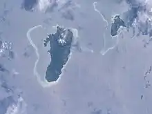
Nairai is an island of Fiji belonging to the Lomaiviti Archipelago. The island is of volcanic origin and has a land area of about 30 square kilometers.[1] To the west of the island is Batiki, and to the south-west is Gau.
Its population of more than 600 Fijians lives in coastal villages.[1] Economic activity is subsistence farming and fishing, with copra farming being the main source of income.[1] The island has no airport, although it has a jetty in Tovulailai.[1] Transport is by local cargo vessels or small boats, since there are no roads for vehicles.[1] One tourist resort is currently under construction.
There are five villages on the island, consisting of Natauloa (the chiefly village and the seat of the Turaga na Tui Nairai and also the high chief of the island), Tovulailai (which has a jetty and a nursing station), Vutuna, Lawaki, and Waitoga.[1] There are three primary schools, although there is no high school.[1]
In the chiefly village of Natauloa, the three chiefly clans, namely Mataqali Valebalavu, Mataqali Namoala and Mataqali Tarani constituted the main landowning units where villages are members by birth through blood link, on the father's side. This link entitles members as joint owners to all designated lands and traditional status registered specifically for individual clans under the iTaukei Land Trust Board and Native Lands Commission (Valenivolavola Ni Kawa Bula).
History
The government of Frank Bainimarama had been very supportive of development works on the island since 2007 and when the government was trying to introduce the People's Charter, which was rejected by the Lomaiviti Provincial Council, it was accepted only by the districts (tikinas) of Nairai and Sawaieke (Gau Island).
After completion of this new wharf, an "around the island road" is also earmarked as a token of appreciation by the government to the Tui Nairai and his people's approval, for wholeheartedly accepting and acknowledging the People's Charter as the new "instrument of change", introduced by them for the people of Fiji.
References
External links
17°48′S 179°25′E / 17.800°S 179.417°E
