Nagasaki Station 長崎駅 | |||||||||||||||
|---|---|---|---|---|---|---|---|---|---|---|---|---|---|---|---|
 The west entrance of Nagasaki Station in April 2020 | |||||||||||||||
| General information | |||||||||||||||
| Location | Onoue-machi, Nagasaki, Nagasaki Japan | ||||||||||||||
| Operated by | |||||||||||||||
| Line(s) | Nagasaki Line | ||||||||||||||
| Platforms | 4 island platforms (2 for Shinkansen, 2 for conventional lines) | ||||||||||||||
| Tracks | 9 (4 for Shinkansen, 5 for conventional lines) | ||||||||||||||
| Construction | |||||||||||||||
| Structure type | Elevated | ||||||||||||||
| History | |||||||||||||||
| Opened | 5 April 1905 | ||||||||||||||
| Passengers | |||||||||||||||
| FY2016 | 10,650 daily | ||||||||||||||
| Rank | 13th (among JR Kyushu stations) | ||||||||||||||
| Services | |||||||||||||||
| |||||||||||||||
| Location | |||||||||||||||
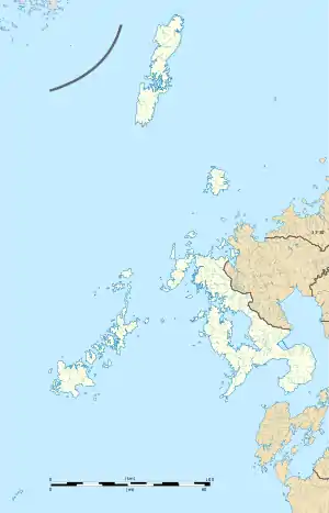
 Nagasaki Station Location within Nagasaki Prefecture  Nagasaki Station Nagasaki Station (Japan) | |||||||||||||||


Nagasaki Station (長崎駅, Nagasaki-eki) is a railway station in Nagasaki, Nagasaki Prefecture, Japan, operated by the Kyushu Railway Company (JR Kyushu). It is the terminus of the Nishi Kyushu Shinkansen and the Nagasaki Main Line.
The station is connected by the Kamome Shinkansen service and the Relay Kamome limited express to Hakata, and by the Seaside Liner rapid service to Sasebo. Nagasaki Electric Tramway services call at a stop in front of the station.
Lines
Station layout
The conventional line station has two elevated island platforms serving five tracks.[1] The Shinkansen station has two island platforms serving four tracks.
Platforms
| Platform No | Line Name | Direction | Notes |
|---|---|---|---|
| Conventional Lines | |||
| 1-5 | ■ Nagasaki Main Line | for Isahaya・Ōmura・Huis Ten Bosch・Haiki・Sasebo | |
| ■ Nagasaki Main Line | for Kikitsu・Isahaya・Kōhoku・Saga・Tosu | ||
| Shinkansen Platform | |||
| 11-14 | for Isahaya・Shin-Ōmura・Takeo-Onsen | Service to Hakata via limited express Relay Kamome, cross-platform transfer available at Takeo-Onsen | |
History
The station was opened on 5 April 1905 when the railway was extended from the former Nagasaki Station to the present station. The former station, opened in 1897, was renamed Urakami Station.
- 5 April 1905 - Opened by Kyushu Railway.
- 1 July 1907 - The railways are nationalized and the station becomes part of Japanese Government Railways.
- 12 October 1909 – Japanese National Railways (JNR) renames the line the Nagasaki Main Line (長崎本線).
- 9 August 1945 – Station damaged in the atomic bombing of the city.
- June 1969 – The elevated station is completed.
- 6 June 1976 – The track between Tosu and Nagasaki is electrified.
- 1 April 1987 – JNR is privatized and the station is inherited by JR Kyushu.
- 28 March 2020 - The station is rebuilt and is opened as a fully elevated station in preparation for the Nishi Kyushu Shinkansen.[2]
- 23 September 2022 - The station is serviced by the Nishi Kyushu Shinkansen with new Shinkansen platforms.[3]
Surrounding area
- Nagasaki Electric Tramway Nagasaki-Ekimae tram stop
- Nagasaki Ken-ei Bus Terminal
- JR Kyushu Nagasaki Railway Division Nagasaki transportation center
- National Route 202
- Amu Plaza Nagasaki
- JR Kyushu Hotel Nagasaki
- Hotel New Nagasaki
- Nishi Kyushu Daiichi Hotel
- Twenty-six Martyrs of Japan
- NHK Nagasaki Broadcasting Station
- Nagasaki Chūō Post Office
Passenger statistics
In fiscal 2016, the station was used by an average of 10,650 passengers daily (boarding passengers only), and it ranked 13th among the busiest stations of JR Kyushu.[4]
References
- ↑ 花村, 隆広. "長崎駅が高架化される". 鉄道ファン・railf.jp (in Japanese).
- ↑ "JR 新「長崎駅」開業 高架化、踏切4カ所廃止 長崎-浦上両駅 新型コロナで式典で中止". 長崎新聞. March 29, 2020. Archived from the original on March 29, 2020. Retrieved March 29, 2020.
- ↑ "西九州新幹線が開業、「かもめ」が出発…博多―長崎間は30分短い最速1時間20分に". 読売新聞オンライン (in Japanese). 2022-09-23. Archived from the original on 23 September 2022. Retrieved 2022-09-26.
- ↑ "駅別乗車人員上位300駅(平成28年度)" [Passengers embarking by station - Top 300 stations (Fiscal 2016)] (PDF). JR Kyushu. 31 July 2017. Archived from the original (PDF) on 1 August 2017. Retrieved 25 February 2018.
32°45′10″N 129°52′14″E / 32.752832°N 129.8705°E