Nävekvarn | |
|---|---|
 Nävekvarn  Nävekvarn | |
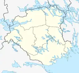
| Coordinates: 58°38′N 16°48′E / 58.633°N 16.800°E | |
| Country | Sweden |
| Province | Södermanland |
| County | Södermanland County |
| Municipality | Nyköping Municipality |
| Area | |
| • Total | 1.11 km2 (0.43 sq mi) |
| Population (31 December 2010)[1] | |
| • Total | 795 |
| • Density | 713/km2 (1,850/sq mi) |
| Time zone | UTC+1 (CET) |
| • Summer (DST) | UTC+2 (CEST) |
| Climate | Cfb |
Nävekvarn (Swedish pronunciation: [nɛvɛˈkvɑːɳ])[2] is a locality situated in Tunaberg, Nyköping Municipality, Södermanland County, Sweden with 795 inhabitants in 2010.[1]
Election results
Nävekvarn has a municipal constituency that covers the locality and the surrounding forests. In all references, the results for Nävekvarn are being found under Nyköping's.
Riksdag
| Year | % | Votes | V | S | MP | C | L | KD | M | SD | NyD | Left | Right |
|---|---|---|---|---|---|---|---|---|---|---|---|---|---|
| 1973[3] | 93.7 | 648 | 6.0 | 70.8 | 12.3 | 4.6 | 1.1 | 5.2 | 76.9 | 21.9 | |||
| 1976[4] | 93.4 | 746 | 3.2 | 66.5 | 18.0 | 3.6 | 0.7 | 7.8 | 69.7 | 29.4 | |||
| 1979[5] | 91.2 | 799 | 4.3 | 65.1 | 14.9 | 4.0 | 0.6 | 10.5 | 69.3 | 29.4 | |||
| 1982[6] | 91.5 | 841 | 4.8 | 68.3 | 1.7 | 10.4 | 2.7 | 1.1 | 10.9 | 73.0 | 24.1 | ||
| 1985[7] | 91.1 | 843 | 4.7 | 65.6 | 1.9 | 9.4 | 8.5 | 9.8 | 70.3 | 27.8 | |||
| 1988[8] | 87.6 | 773 | 5.6 | 63.4 | 6.9 | 4.9 | 6.0 | 2.8 | 10.1 | 75.8 | 21.0 | ||
| 1991[9] | 87.4 | 817 | 5.3 | 54.2 | 4.7 | 6.9 | 3.7 | 5.5 | 12.0 | 7.6 | 59.5 | 28.0 | |
| 1994[10] | 88.9 | 833 | 8.0 | 62.4 | 3.5 | 4.7 | 2.9 | 4.1 | 12.5 | 1.4 | 71.9 | 24.1 | |
| 1998[11] | 82.1 | 779 | 14.0 | 52.6 | 3.6 | 4.4 | 1.3 | 10.1 | 11.9 | 70.2 | 27.7 | ||
| 2002[12] | 80.0 | 784 | 11.5 | 52.0 | 5.6 | 4.7 | 6.7 | 6.7 | 10.8 | 1.5 | 69.1 | 28.8 | |
| 2006[13] | 86.1 | 860 | 6.4 | 48.0 | 5.1 | 7.2 | 4.7 | 7.3 | 16.3 | 3.0 | 59.5 | 35.5 | |
| 2010[14] | 85.7 | 857 | 6.9 | 38.6 | 7.8 | 5.5 | 5.1 | 4.3 | 24.5 | 6.5 | 53.3 | 39.4 | |
| 2014[15] | 87.2 | 831 | 7.2 | 40.0 | 7.0 | 5.5 | 2.1 | 3.7 | 16.1 | 16.3 | 54.2 | 27.4 | |
| 2018[16] | 87.2 | 775 | 7.0 | 36.0 | 4.3 | 7.4 | 1.7 | 5.7 | 14.1 | 22.2 | 54.6 | 43.6 | |
| 2022[17] | 84.0 | 746 | 6.6 | 35.1 | 5.8 | 4.3 | 2.9 | 6.3 | 13.8 | 25.1 | 51.7 | 48.1 |
References
- 1 2 3 "Tätorternas landareal, folkmängd och invånare per km2 2005 och 2010" (in Swedish). Statistics Sweden. 14 December 2011. Archived from the original on 27 January 2012. Retrieved 10 January 2012.
- ↑ Jöran Sahlgren; Gösta Bergman (1979). Svenska ortnamn med uttalsuppgifter (in Swedish). p. 19.
- ↑ "Allmänna valen 1973" (PDF) (in Swedish). SCB.
- ↑ "Allmänna valen 1976" (PDF) (in Swedish). SCB.
- ↑ "Allmänna valen 1979" (PDF) (in Swedish). SCB.
- ↑ "Allmänna valen 1982" (PDF) (in Swedish). SCB.
- ↑ "Allmänna valen 1985" (PDF) (in Swedish). SCB.
- ↑ "Allmänna valen 1988" (PDF) (in Swedish). SCB.
- ↑ "Allmänna valen 1991" (PDF) (in Swedish). SCB.
- ↑ "Allmänna valen 1994" (PDF) (in Swedish). SCB.
- ↑ "Allmänna valen 1998" (PDF) (in Swedish). SCB.
- ↑ "Nävekvarn - summering" (in Swedish). Valmyndigheten.
- ↑ "Allmänna val 17 september 2006 - Nävekvarn" (in Swedish). Valmyndigheten.
- ↑ "Nävekvarn - Röster Val 2010" (in Swedish). Valmyndigheten.
- ↑ "Nävekvarn - Röster Val 2014" (in Swedish). Valmyndigheten.
- ↑ "Nävekvarn - Röster Val 2018" (in Swedish). Valmyndigheten.
- ↑ "Nävekvarn - Röster Val 2022" (in Swedish). Valmyndigheten.
This article is issued from Wikipedia. The text is licensed under Creative Commons - Attribution - Sharealike. Additional terms may apply for the media files.