| Mount Thayer | |
|---|---|
.jpg.webp) Mount Thayer seen from Mount Umunhum | |
| Highest point | |
| Elevation | 3,479 ft (1,060 m) NAVD 88[1] |
| Coordinates | 37°09′50″N 121°55′07″W / 37.163855539°N 121.918707136°W[1] |
| Geography | |
 Mount Thayer Location in California | |
| Location | Santa Clara County, California, U.S. |
| Parent range | Santa Cruz Mountains |
| Topo map | USGS Los Gatos |
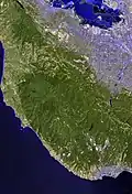
Mount Thayer is a mountain in the Santa Cruz mountain range located in Santa Clara County, California. The summit is in a section of the abandoned Almaden Air Force Station, about 1 mile west of Mount Umunhum. The elevation of the summit is at 3,479 feet (1,060 m) feet. An old derelict building, surrounded by telephone poles, is located on the summit. Mount Thayer, along with the surrounding property, is off limits to the public.[2]
See also
References
- 1 2 "Thayer 2 reset". NGS Data Sheet. National Geodetic Survey, National Oceanic and Atmospheric Administration, United States Department of Commerce.
- ↑ "Sierra Azul Open Space Preserve — map showing restricted access areas" (PDF). Midpeninsula Regional Open Space District. Retrieved 2009-08-16.
External links
This article is issued from Wikipedia. The text is licensed under Creative Commons - Attribution - Sharealike. Additional terms may apply for the media files.
