Morsbach | |
|---|---|
 | |
 Flag  Coat of arms | |
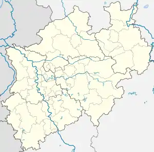
Location of Morsbach within Oberbergischer Kreis district  | |
 Morsbach  Morsbach | |
| Coordinates: 50°52′N 7°43′E / 50.867°N 7.717°E | |
| Country | Germany |
| State | North Rhine-Westphalia |
| Admin. region | Köln |
| District | Oberbergischer Kreis |
| Government | |
| • Mayor (2020–25) | Jörg Bukowski[1] (Ind.) |
| Area | |
| • Total | 55.96 km2 (21.61 sq mi) |
| Elevation | 206 m (676 ft) |
| Population (2021-12-31)[2] | |
| • Total | 10,093 |
| • Density | 180/km2 (470/sq mi) |
| Time zone | UTC+01:00 (CET) |
| • Summer (DST) | UTC+02:00 (CEST) |
| Postal codes | 51597 |
| Dialling codes | 02294 |
| Vehicle registration | GM |
| Website | www |
Morsbach is a municipality in Oberbergischer Kreis, a district in North Rhine-Westphalia near the border of Rhineland-Palatinate in Germany. In 2015, Morsbach's population was 10,600. The central village, also named Morsbach, has a population of 3,400. With a number of buildings dating back to the 12th century, it is a popular spot for hikers and other nature lovers.
Geography
Morsbach is 50 kilometres (31 mi) east of Cologne, in the southern corner of the Oberbergischer Kreis of North Rhine-Westphalia near its border with Rhineland-Palatinate. In 2015, its population was 10,600.[3]
Subdivisions
The municipality (Gemeinde) is divided into 66 subdivisions (Ortsteile).[4] In alphabetical order, they are:
- Alzen, Amberg, Appenhagen
- Berghausen, Birken, Birzel, Bitze, Böcklingen, Breitgen, Burg Volperhausen
- Ellingen, Erblingen, Euelsloch, Eugenienthal
- Flockenberg, Frankenthal
- Hahn, Halle, Hammer, Heide, Hellerseifen, Herbertshagen, Holpe, Hülstert
- Katzenbach, Kömpel, Korseifen
- Ley, Lichtenberg, Lützelseifen
- Neuhöfchen, Niederasbach, Niederdorf, Niederwarnsbach, Niederzielenbach
- Oberasbach, Oberholpe, Oberwarnsbach, Oberzielenbach, Ölmühle, Ortseifen
- Reinshagen, Rhein, Ritterseifen, Rolshagen, Rom, Rosengarten, Rossenbach
- Schlechtingen, Seifen, Siedenberg, Solseifen, Springe, Steimelhagen, Stentenbach, Stockshöhe, Straßerhof, Strick
- Überasbach, Überholz
- Volperhausen
- Wallerhausen, Wendershagen, Wittershagen
- Zinshardt
History
- 4000-1800 BC: First settlement in the region, dating back to the Neolithic Age. A stone hatchet and a fragment of a flint blade have been found.
- 800 AD: Morschbach is part of Charlemagne's Holy Roman Empire. The parish of Morsbach was administered by the court officials of Sayn.
- 895: Morsbach is first mentioned in Duplicate of an Archival Book of the Inhabitants of Bonn, Saint Cassius Parish, which also mentions the Oberberg communities.
- 31 March 1131: Pope Innocent II mentions the Morsbach church.
- 1174: The counts along the Wupper received Windeck Castle from Earl Heinrich Raps of Thuringia as a gift.
- c. 1500: A chapel is built in Holpe as a branch church of Morsbach.
- 1563: The counts of Sayn-Homburg authorize a Lutheran church. The parish of Morsbach remains Catholic, and the Lutheran parish is in Holpe.
- 1634: Morsbach becomes a fiefdom of Count Hermann von Hatzfeldt.
- 1661: The fiefdom is reclaimed by Philipp Wilhelm von Berg.
- 1795: During the War of the First Coalition, French forces cross the Rhine, seize the Duchy of Berg and camp in Morsbach.
- 1805: Prince-elector Maximilian Joseph von Pfalz-Zweibrücken forms an alliance with Napoleon and becomes the king of Bavaria.
- 1806: Berg becomes a grand duchy, with Joachim Murat (Napoleon's brother-in-law) its regent.
- 1932: Kreis Waldbröl and Gummersbach are combined to form Oberbergischer Kreis. Morsbach has about 5,300 inhabitants, and its borders have been nearly unchanged for centuries.
- 1946: Oberbergischer Kreis becomes part of North Rhine-Westphalia in West Germany.
Coat of arms
Morsbach's coat of arms was granted on August 14, 1937. The upper part is a lion (symbolic of the Counts of Berg), and the lower part is a marshy brook.
Population
| Year | 1838 | 1866 | 1939 | 1950 | 1960 | 1972 | 1980 | 1984 | 2000 | 2002 |
|---|---|---|---|---|---|---|---|---|---|---|
| Population | 3,563 | 3,857 | 5,685 | 6,979 | 7,155 | 9,689 | 10,669 | 10,565 | 12,250 | 12,337 |
Points of interest
- The Romanesque Saint Gertrud basilica, whose tower dates to the second half of the 12th century; other sections date to the first half of the 13th century.[5]
- Castle Volperhausen
- The heritage-protected Morsbach station building. According to its preservation order, "The preservation of this building is of public interest because of its locally influenced design of the uniform Prussian station building type and also because of its special roof design."[6]
Twin towns
- Großrosseln (state of Saarland, Germany)
- Milly-la-Forêt (département of Essonne, France)
References
- ↑ Wahlergebnisse in NRW Kommunalwahlen 2020, Land Nordrhein-Westfalen, accessed 29 June 2021.
- ↑ "Bevölkerung der Gemeinden Nordrhein-Westfalens am 31. Dezember 2021" (in German). Landesbetrieb Information und Technik NRW. Retrieved 20 June 2022.
- ↑ "Daten & Fakten". Gemeinde Morsbach. Retrieved 2019-10-30.
- ↑ "PLZ Morsbach mit Karte | Postleitzahlen 51597 Nordrhein-Westfalen". www.plz-suche.org (in German). Retrieved 2019-10-15.
- ↑ "Sehenswürdigkeiten in Morsbach". Gemeinde Morsbach. Retrieved 2019-10-30.
- ↑ "Wiehltalbahn". Retrieved 26 November 2019.
Bibliography
- Christoph Buchen / Erwin Weber: Alt Morsbach. Die Gemeinde Morsbach in alten Bildern, Meinerzhagen 1981
- Morsbach. Chronik einer oberbergischen Gemeinde, hg. von der Gemeinde Morsbach, Meinerzhagen 1987
- 1100 Jahre Morsbach. 895 - 1995, hg. von der Gemeinde Morsbach, Waldbröl 1995
External links
- Official site (in German)