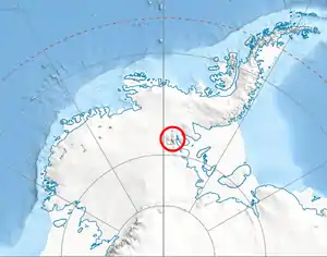

Monyak Hill (Bulgarian: хълм Моняк, ‘Halm Monyak’ \'h&lm 'mo-nyak\) is the rocky hill rising to 864 m[1] at the north extremity of Flowers Hills on the east side of Sentinel Range in Ellsworth Mountains, Antarctica. It surmounts Dater Glacier to the west, Ellen Glacier to the north, and Lardeya Ice Piedmont to the east.
The feature is named after the medieval fortress of Monyak in southern Bulgaria.
Location
Monyak Hill is located at 78°18′28″S 84°30′29″W / 78.30778°S 84.50806°W, which is 4.6 km north of Dickey Peak, 12.75 km east-northeast of Mount Levack in Sullivan Heights, and 11.2 km south-southeast of Mount Besch in Barnes Ridge. US mapping in 1988.
Maps
- Vinson Massif. Scale 1:250 000 topographic map. Reston, Virginia: US Geological Survey, 1988.
- Antarctic Digital Database (ADD). Scale 1:250000 topographic map of Antarctica. Scientific Committee on Antarctic Research (SCAR). Since 1993, regularly updated.
Notes
- ↑ Reference Elevation Model of Antarctica. Polar Geospatial Center. University of Minnesota, 2019
References
- Monyak Hill. SCAR Composite Antarctic Gazetteer.
- Bulgarian Antarctic Gazetteer. Antarctic Place-names Commission. (details in Bulgarian, basic data in English)
External links
- Monyak Hill. Copernix satellite image
This article includes information from the Antarctic Place-names Commission of Bulgaria which is used with permission.
.svg.png.webp)