Montfort | |
|---|---|
Small city | |
_Roerdriehoekmuseum.JPG.webp) Museum in Montfort | |
_vlag.svg.png.webp) Flag .svg.png.webp) Coat of arms | |
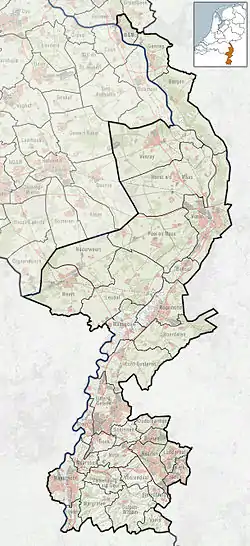
 Montfort Location in the Netherlands  Montfort Location in the province of Limburg in the Netherlands | |
| Coordinates: 51°07′45″N 5°56′45″E / 51.12917°N 5.94583°E | |
| Country | Netherlands |
| Province | Limburg |
| Municipality | Roerdalen |
| Area | |
| • Total | 12.61 km2 (4.87 sq mi) |
| Elevation | 27 m (89 ft) |
| Population (2021)[1] | |
| • Total | 3,130 |
| • Density | 250/km2 (640/sq mi) |
| Time zone | UTC+1 (CET) |
| • Summer (DST) | UTC+2 (CEST) |
| Postal code | 6065[1] |
| Dialing code | 0475 |
| Major roads | A73 |
Montfort (Limburgish: Mofert) is a small city in the Dutch province of Limburg. Montfort has about 3,000 inhabitants. It lies about 8 km south of Roermond. It received city rights in 1271 and is renowned for the ruins of Castle Montfort, built in the 13th century.
Until 1991, Montfort was a separate municipality. It then became part of Posterholt, which was later renamed Ambt Montfort.[3]
Since 1 January 2007, Montfort has been part of the municipality of Roerdalen.
Places of interest
- The ruin of Castle Montfort. This castle was built around 1260 by Hendrik III of Gelre. For centuries it was the governmental centre of Ambt Montfort.
- The presbytery of Montfort is also one of Montfort's historic buildings.
- The mass graves and monuments on the cemetery. Most of the victims of the bombardments of Montfort at the end of the Second World War are buried here. The number of victims was high because at the time Montfort was a regional refugee sanctuary with 6 times its current population.
- The historical centre of Montfort. Most of the buildings in this part of the town are from the late 1950s because most of the original buildings were destroyed during the Second World War.
 The ruin of Castle Montfort
_Rijksmonument_47063_pastorie.JPG.webp) presbytery of Montfort
presbytery of Montfort_massagraf.JPG.webp) The monuments on the cemetery in Montfort
The monuments on the cemetery in Montfort_sculpture_de_Sji%C3%ABper%252C_by_Henk_Sillen%252C_1989.JPG.webp) Sculpture of "Sjieëper" (Shepherd), by Henk Sillen
Sculpture of "Sjieëper" (Shepherd), by Henk Sillen
Landscape
- Montfort is surrounded by forests, such as 't Sweeltje, Munichsbosch, Roozendaal and Reigershorst.
Notable people
- Jos Verstappen (car racing driver)
- Max Verstappen (car racing driver)
References
Wikimedia Commons has media related to Montfort, Roerdalen.
- 1 2 3 "Kerncijfers wijken en buurten 2021". Central Bureau of Statistics. Retrieved 25 April 2022.
- ↑ "Postcodetool for 6065AA". Actueel Hoogtebestand Nederland (in Dutch). Het Waterschapshuis. Retrieved 25 April 2022.
- ↑ Ad van der Meer and Onno Boonstra, "Repertorium van Nederlandse gemeenten", KNAW, 2006. Knaw.nl, Koninklijke Nederlandse Akademie van Wetenschappen (KNAW), Royal Netherlands Academy of Arts and Sciences
External links
This article is issued from Wikipedia. The text is licensed under Creative Commons - Attribution - Sharealike. Additional terms may apply for the media files.