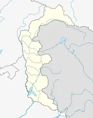
Mong
منگ | |
|---|---|
 Mong  Mong | |
| Coordinates: 33°47′50″N 73°38′09″E / 33.797301°N 73.635772°E | |
| Country | Kashmir |
| Territory | Azad Kashmir |
| District | Sudhnoti District |
| Area | |
| • Total | 1,010 km2 (390 sq mi) |
| Elevation | 1,400 m (4,500 ft) |
| Population (2017)[1] | |
| • Total | 297,584 (Sudhnoti District population including the village Mong Azad Kashmir) |
| • Density | 375/km2 (970/sq mi) |
| Time zone | UTC+5 (PST) |
| Calling code | 05827 |
| Number of Villages | 7 |
| Number of Union councils | 3, (Mong, Patan Shar Khan, and Dhingroon Kanchri) |
Mong (also called Mang) is a city and village in Sudhnoti District of Azad Kashmir, Pakistan.
Geography

Mong
Mong consists of 7 villages and 3 union councils: Mong, Patan Sher Khan, and Dhingroon Kanchri. The major villages in Mong are Mehna Naar'orri, Dhara & Daar, Thaneliyaan Khoor, Kanchri, Dhingroon and Pattan Sher Khan.
Mong is well connected by roads to major cities of Kashmir and Pakistan. Mong is connected to Pallandri, Rawalakot, Thorar. Daily buses carry passengers inter-state as well as within the city. The nearest major airport is located at Rawalakot.[2]
Education
Mong has several schools and a campus of the University of Poonch.
Notable people
- Khan of Mong Captain Khan Muhammad Khan, guerrilla leader in the First Kashmir War.[3]
References
- ↑ "Sudhnoti District population including the village Mong, Azad Kashmir per 2017 census". Citypopulation.de website. Archived from the original on 29 June 2020. Retrieved 7 January 2024.
- ↑ Mong, Azad Kashmir on Google Maps website
- ↑ Effendi, Col. M. Y. (2007), Punjab Cavalry: Evolution, Role, Organisation and Tactical Doctrine 11 Cavalry, Frontier Force, 1849-1971, Karachi: Oxford University Press, pp. 157–160, ISBN 978-0-19-547203-5
This article is issued from Wikipedia. The text is licensed under Creative Commons - Attribution - Sharealike. Additional terms may apply for the media files.