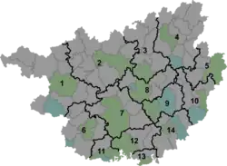
Minglun
明伦镇 | |||||||
|---|---|---|---|---|---|---|---|
 Minglun Location in Guangxi | |||||||
| Coordinates: 25°12′58″N 108°24′35″E / 25.21611°N 108.40972°E | |||||||
| Country | People's Republic of China | ||||||
| Autonomous region | Guangxi | ||||||
| Prefecture-level city | Hechi | ||||||
| Autonomous county | Huanjiang Maonan Autonomous County | ||||||
| Incorporated (township) | 1984 | ||||||
| Designated (town) | 1995 | ||||||
| Area | |||||||
| • Total | 447.96 km2 (172.96 sq mi) | ||||||
| Population (2019) | |||||||
| • Total | 41,149 | ||||||
| • Density | 92/km2 (240/sq mi) | ||||||
| Time zone | UTC+08:00 (China Standard) | ||||||
| Postal code | 547115 | ||||||
| Area code | 0778 | ||||||
| Chinese name | |||||||
| Simplified Chinese | 明伦镇 | ||||||
| Traditional Chinese | 明倫鎮 | ||||||
| |||||||
Minglun (Chinese: 明伦镇) is a town in Huanjiang Maonan Autonomous County, Guangxi, China. As of the 2019 census it had a population of 41,149 and an area of 447.96-square-kilometre (172.96 sq mi).
Administrative division
As of 2021, the town is divided into one community and fifteen villages:
- Minglun Community (明伦社区)
- Yajing (雅京村)
- Longshui (龙水村)
- Xiangyao (相尧村)
- Baoshan (豹山村)
- Caibo (才帛村)
- Cuishan (翠山村)
- Baixiang (百祥村)
- Jixiang (吉祥村)
- Gancheng (干城村)
- Beisong (北宋村)
- Yinghao (英豪村)
- Bamian (八面村)
- Hekuang (合狂村)
- Haodong (豪洞村)
- Liuping (柳平村)
History
The area belonged to Anhua Department (安化厅) in 1905, during the late Qing dynasty (1644–1911).[1]
In 1912, it was renamed "Anhua County" (安化县) and soon renamed "Yibei County" (宜北县) in January 1914, and came under the jurisdiction of Liujiang Municipality (柳江道).[2]
On 20 November 1949, the People's Liberation Army (PLA) took control of Yibei County and it came under the jurisdiction of Qingyuan Special District (庆远专区).[2] One year later, it was under the jurisdiction of Yishan Special District (宜山专区).[2] On 11 August 1952, Yibei County and Si'en County (思恩县) merged to form Huanjiang County (环江县), and the area belonged to Minglun District (明伦区).[3] In 1958, Xianfeng People's Commune (先锋人民公社) was set up and one year later reverted to its former name of Minglun District.[3] It was incorporated as a township in 1984.[3] In 1995, it was upgraded to a town.[3]
Geography
The town is situated at the north of Huanjiang Maonan Autonomous County.[4] It borders Xunle Miao Ethnic Township in the north, Dongxing Town and Longyan Township in the east, Da'an Township and Changmei Township in the south, and Luoyang Town in the west.[4]
The highest point in the town is Dadingmao Mountain (大顶帽山) which stands 1,073.2 metres (3,521 ft) above sea level.[4] The lowest point is located in the village of Hekuang (合狂村), which, at 253.1 metres (830 ft) above sea level.[4]
There are two streams in the town: Shangbang Stream (上帮河) and Minglun Stream (明伦河).[4]
Climate
The town is in the subtropical monsoon climate zone, with an average annual temperature of 18 °C (64 °F), total annual rainfall of 1,300-millimetre (51 in), and a frost-free period of 306 days.[4]
Economy
The economy is supported primarily by agriculture and mineral resources.[4] Significant crops include rice and corn.[4] Sugarcane is one of the important economic crops in the region.[4] The region abounds with anthracite, lead, zinc, and pyrrhotite.[4]
Demographics
| Year | Pop. | ±% |
|---|---|---|
| 2011 | 38,122 | — |
| 2019 | 41,149 | +7.9% |
The 2019 census reported the town had a population of 41,149.
Tourist attractions
The Former Residence of Lu Tao (卢焘将军故里) is a popular attraction.[5]
Transportation
The town is crossed by the Provincial Highway S209.
Notable people
- Lu Tao (1882–1949), general of the Republic of China and governor of Guizhou.
- Lu Xianbian (born 1962), Chinese Communist politician, vice chairperson of the Guangxi People's Congress.
- Qin Zhan (覃展), Chinese Communist politician.
References
- ↑ Jiang Xiangming 2008, p. 17.
- 1 2 3 Jiang Xiangming 2008, p. 14.
- 1 2 3 4 Jiang Xiangming 2008, p. 22.
- 1 2 3 4 5 6 7 8 9 10 Han Yuanli (韩元利), ed. (2018). 中华人民共和国政区大典 广西壮族自治区卷 [The Grand Ceremony of the People's Republic of China: Guangxi Zhuang Autonomous Region Volume] (in Chinese). Beijing: China Society Press. pp. 1955–1956. ISBN 9787508757742.
- ↑ Jiang Xiangming 2008, p. 200.
Bibliography
- Jiang Xiangming, ed. (2008). 《环江毛南族自治县概况》 [General Situation of Huanjiang Maonan Autonomous County] (in Chinese). Beijing: Nationalities Publishing House. ISBN 978-7-105-08616-0.