Mesa Prieta | |
|---|---|
 | |
 Mesa Prieta | |
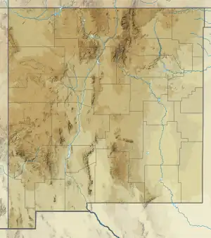
| Coordinates: 35°28′26″N 107°03′12″W / 35.473951°N 107.053356°W | |
| Location | confluence of the Rio Grande and the Embudo Creek |
| Formed by | basaltic lava flow approximately 3.3 myr |
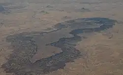
Mesa Prieta is a mesa in Sandoval County New Mexico. The mesa was formed by a basaltic lava flow approximately 3.3 myr. When the Rio Grande began to flow through the area, it eroded the softer sedimentary layers beneath the basaltic layer creating a mesa.[1] The sedimentary rocks include the Cretaceous Dakota Sandstone, Mancos Shale, and Gallup Sandstone.[2]
Rio Puerco flows south on the west side of the mesa. The Ojito Wilderness is to the east of the mesa, and Cabezon Peak is to the north.
Petroglyphs
The basaltic rocks of the mesa naturally form a patina which can be scraped by humans to create petroglyphs. Mesa Prieta is the site of one of the largest collections of petroglyphs in New Mexico. Archaeological surveys have estimated that there are anywhere between 50,000 and 100,000 petroglyphs on the Mesa.[3] These artifacts contain examples from the Archaic,[4] Pueblo, and Spanish[5] periods and show evidence of human habitation in the region dating back 10,000 years ago.
See also
References
- ↑ "Mesa Prieta - The Place". www.mesaprietapetroglyphs.org. Mesa Prieta Petroglyph Project. Retrieved 2019-07-01.
- ↑ Dillinger, J. K., 1990. Geologic map of the Grants 30' x 60' quadrangle, west-central New Mexico, U.S. Geological Survey, Coal Investigations Map C-118-A. Map Scale: 1:100,000.
- ↑ Weideman, Paul (2018-09-21). "Rocks of ages: The Mesa Prieta Petroglyph Project". www.santafenewmexican.com. The New Mexican. Retrieved 2019-07-01.
- ↑ MacKenzie, Janet; Borduin, Candie (2018-11-10). "Archaic Period Petroglyphs of Mesa Prieta". New Mexico Archaeological Council.
- ↑ MacKenzie, Janet (2018-09-07). "Historic Period on Mesa Prieta". BLM Wild and Scenic Rivers Anniversary.
