Mean Chey
ឃុំមានជ័យ | |
|---|---|
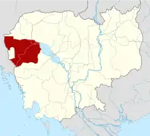
 Mean Chey Map highlighting Mean Cheay | |
| Coordinates: 12°42′26″N 102°45′16″E / 12.7073°N 102.7544°E | |
| Country | |
| Province | Battambang Province |
| District | Samlout District |
| Villages | 6 |
| Time zone | UTC+07 |
| Geocode | 020906 |
Mean Chey (Khmer: ឃុំមានជ័យ) is a khum (commune) of Samlout District in Battambang Province in north-western Cambodia.[1]
Villages
- Sre Sdao
- Kampong Touk
- Sre Chi Pao
- Kam Chat
- Ambib
- Ta Non
References
- ↑ "Statistics of the Cambodian Government". Archived from the original on 2008-12-24.
This article is issued from Wikipedia. The text is licensed under Creative Commons - Attribution - Sharealike. Additional terms may apply for the media files.
