| Maurha Estate | |||||||
|---|---|---|---|---|---|---|---|
| Taluqdar of British India | |||||||
| c. 1894–1948 | |||||||
 Flag
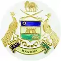
 Coat of arms
| |||||||
| History | |||||||
• Established | c. 1894 | ||||||
| 1948 | |||||||
| |||||||
| Today part of | India | ||||||
Maurha | |
|---|---|
Village | |
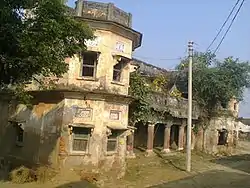
 Maurha Fort | |
 Maurha Location in Uttar Pradesh, India  Maurha Maurha (India) | |
| Coordinates: 26°03′13″N 83°55′07″E / 26.053624°N 83.918529°E | |
| Country | |
| State | Uttar Pradesh |
| District | Ballia |
| Founded by | Raja Mohar Singh |
| Government | |
| • Body | Gram panchayat |
| Population (2011) | |
| • Total | 555 |
| Languages | |
| • Official | Hindi and Bhojpuri |
| Time zone | UTC+5:30 (IST) |
| PIN | 221718 |
| Vehicle registration | UP |
| Website | up |
Maurha is a village and a Gram panchayat in Ballia district in the Indian state of Uttar Pradesh. Its population is 555, per the 2011 Census.[1] Maurha's nearest railway station is Belthara Road. During British India it was a Taluqdari
Maurha has an ancient temple of Lord Shiva on its outskirts, which is believed to have been constructed in the 16th century AD.
References
External links
This article is issued from Wikipedia. The text is licensed under Creative Commons - Attribution - Sharealike. Additional terms may apply for the media files.