Maple Bush No. 224 | |
|---|---|
| Rural Municipality of Maple Bush No. 224 | |
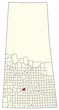
 Location of the RM of Maple Bush No. 224 in Saskatchewan | |
| Coordinates: 50°58′52″N 106°46′19″W / 50.981°N 106.772°W[1] | |
| Country | Canada |
| Province | Saskatchewan |
| Census division | 7 |
| SARM division | 2 |
| Formed[2] | December 13, 1909 |
| Government | |
| • Reeve | Maurice Bartzen |
| • Governing body | RM of Maple Bush No. 224 Council |
| • Administrator | JoAnne 'Rene' Wandler |
| • Office location | Riverhurst |
| Area (2016)[4] | |
| • Land | 811.95 km2 (313.50 sq mi) |
| Population (2016)[4] | |
| • Total | 192 |
| • Density | 0.2/km2 (0.5/sq mi) |
| Time zone | CST |
| • Summer (DST) | CST |
| Area code(s) | 306 and 639 |
The Rural Municipality of Maple Bush No. 224 (2016 population: 192) is a rural municipality (RM) in the Canadian province of Saskatchewan within Census Division No. 7 and SARM Division No. 2. It is located in the southwest portion of the province.
History
The RM of Maple Bush No. 224 incorporated as a rural municipality on December 13, 1909.[2]
Geography
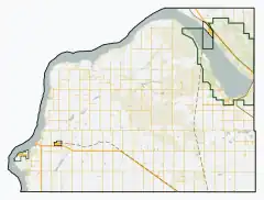
The RM is adjacent to Lake Diefenbaker and is home to Douglas Provincial Park.
Communities and localities
The following urban municipalities are surrounded by the RM.
The following unincorporated communities are within the RM.
- Localities
- Gilroy
- Grainland
- Lawson, dissolved as a village, December 31, 1985
Demographics
In the 2021 Census of Population conducted by Statistics Canada, the RM of Maple Bush No. 224 had a population of 213 living in 105 of its 188 total private dwellings, a change of 10.9% from its 2016 population of 192. With a land area of 818.05 km2 (315.85 sq mi), it had a population density of 0.3/km2 (0.7/sq mi) in 2021.[7]
In the 2016 Census of Population, the RM of Maple Bush No. 224 recorded a population of 192 living in 82 of its 164 total private dwellings, a 15% change from its 2011 population of 167. With a land area of 811.95 km2 (313.50 sq mi), it had a population density of 0.2/km2 (0.6/sq mi) in 2016.[4]
Attractions
- Palliser Regional Park (50°53′25″N 106°56′32″W / 50.8903°N 106.9423°W)[8] is a regional park on Lake Diefenbaker, about 8 kilometres (5.0 mi) south-west of Riverhurst.[9] It is named after John Palliser — namesake of the Palliser expedition[10] — who reportedly camped in or near the park site in 1857.[11][12][13] Amenities at the park include a campground, Sage View Golf Course, marina, picnic area, beach, pickleball courts, and a heated swimming pool. The park was founded in 1962.[14][15]
- Sage View Golf Course is a 9-hole, grass greens course at Palliser Regional Park that was constructed in 1992. The golf course is par 36 with 2,998 yards with elevation changes through coulees. The golf course overlooks Lake Diefenbaker and has a licensed restaurant, banquet hall, pro shop, rentals, and a driving range.[16][17]
- Douglas Provincial Park
- Elbow crater
- F.T. Museum
- Qu'Appelle River Dam
- Riverhurst Ferry
Government
The RM of Maple Bush No. 224 is governed by an elected municipal council and an appointed administrator that meets on the second Wednesday of every month.[3] The reeve of the RM is Maurice Bartzen while its administrator is JoAnne 'Rene' Wandler.[3] The RM's office is located in Riverhurst.[3]
References
- ↑ "Pre-packaged CSV files - CGN, Canada/Province/Territory (cgn_sk_csv_eng.zip)". Government of Canada. July 24, 2019. Retrieved May 23, 2020.
- 1 2 "Rural Municipality Incorporations (Alphabetical)". Saskatchewan Ministry of Municipal Affairs. Archived from the original on April 21, 2011. Retrieved May 9, 2020.
- 1 2 3 4 "Municipality Details: RM of Maple Bush No. 224". Government of Saskatchewan. Retrieved May 21, 2020.
- 1 2 3 "Population and dwelling counts, for Canada, provinces and territories, and census subdivisions (municipalities), 2016 and 2011 censuses – 100% data (Saskatchewan)". Statistics Canada. February 8, 2017. Retrieved May 1, 2020.
- ↑ "Saskatchewan Census Population" (PDF). Saskatchewan Bureau of Statistics. Archived from the original (PDF) on September 24, 2015. Retrieved May 9, 2020.
- ↑ "Saskatchewan Census Population". Saskatchewan Bureau of Statistics. Retrieved May 9, 2020.
- ↑ "Population and dwelling counts: Canada, provinces and territories, census divisions and census subdivisions (municipalities), Saskatchewan". Statistics Canada. February 9, 2022. Retrieved April 13, 2022.
- ↑ "Palliser Regional Park". Canadian Geographical Names Database. Government of Canada. Retrieved August 6, 2023.
- ↑ Snook, Michael (2004). Fishing Saskatchewan: An Angler's Guide to Provincial Waters. University of Regina Press. p. 155. ISBN 978-0-88977-166-6.
- ↑ Hanna, Kevin S.; Clark, Douglas A.; Slocombe, D. Scott (October 18, 2007). Transforming Parks and Protected Areas: Policy and Governance in a Changing World. Routledge. p. 182. ISBN 978-1-134-19009-6.
- ↑ Clancy, Michael; Clancy, Anna (2006). A User's Guide to Saskatchewan Parks. University of Regina Press. p. 37. ISBN 978-0-88977-198-7.
- ↑ The Papers of the Palliser Expedition, 1857–1860. Toronto: Champlain Society. 1968. p. 152.
- ↑ South Saskatchewan River Development Project: Progress Report for the Period 1958 to 1963. Regina, Saskatchewan: South Saskatchewan River Development Commission. 1963. p. 1978.
- ↑ "Palliser". Regional Parks of Saskatchewan. Saskatchewan Regional Parks. Retrieved August 8, 2023.
- ↑ "Palliser Regional Park". Tourism Saskatchewan. Government of Saskatchewan. Retrieved August 8, 2023.
- ↑ "Sage View Golf Course". GolfPass. Retrieved August 8, 2023.
- ↑ "Sage View Golf Course". Tourism Saskatchewan. Government of Saskatchewan. Retrieved August 8, 2023.

