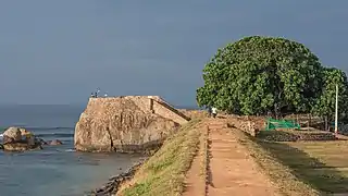
| Mannar Fort | |
|---|---|
| Mannar, Sri Lanka | |
 Mannar Fort | |
| Coordinates | 8°58′33″N 79°55′01″E / 8.975864°N 79.917013°E |
| Type | Defence fort |
| Site information | |
| Open to the public | Yes |
| Condition | Good |
| Site history | |
| Built | 1560 |
| Built by | Portuguese and Dutch |
| Materials | Granite Stones and bricks |
Mannar Fort (Tamil: மன்னார்க் கோட்டை, romanized: Maṉṉārk Kōṭṭai; Sinhala: මන්නාරම් බලකොටුව Mannaram Balakotuwa) is located on Mannar Island, Sri Lanka. It was built by Portuguese in 1560 and christened São Jorge.[1][2] The fort fell to the Dutch in 1658, and they rebuilt the fort in 1696. In 1795 the British occupied the fort following the surrender by the Dutch.[3][4]
It is a square-shaped fort with four bastions and is located next to the new bridge that connects the mainland with the Mannar Island.[5]
The fort is currently occupied by the Department of Archeology.
References
- ↑ Shihan de Silva Jayasuriya, Jean-Pierre Angenot: Uncovering the History of Africans in Asia, BRILL, 2008, p. 16.
- ↑ Boletim do Governo do Estado da India, Imprensa Nacional, 1865, p. 641.
- ↑ "Mannar Fort". Retrieved 11 November 2014.
- ↑ "Lost history of Mannar". Archived from the original on 11 November 2014. Retrieved 11 November 2014.
- ↑ "A journey to the island of Mannar". Retrieved 11 November 2014.
- Nelson, W. A.; de Silva, R. K. (2004). The Dutch Forts of Sri Lanka – The Military Monuments of Ceylon. Sri Lanka Netherlands Association.
This article is issued from Wikipedia. The text is licensed under Creative Commons - Attribution - Sharealike. Additional terms may apply for the media files.
_fort.jpg.webp)
