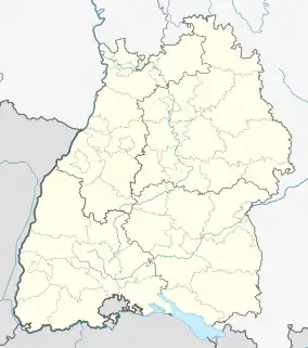
Kusterdingen | |
|---|---|
Location of Kusterdingen within Tübingen district  | |
 Kusterdingen  Kusterdingen | |
| Coordinates: 48°31′52″N 9°08′54″E / 48.5312°N 9.1484°E | |
| Country | Germany |
| State | Baden-Württemberg |
| Admin. region | Tübingen |
| District | Tübingen |
| Subdivisions | 5 Ortsteile |
| Government | |
| • Mayor (2018–26) | Jürgen Soltau[1] (Ind.) |
| Area | |
| • Total | 24.24 km2 (9.36 sq mi) |
| Elevation | 405 m (1,329 ft) |
| Population (2021-12-31)[2] | |
| • Total | 8,714 |
| • Density | 360/km2 (930/sq mi) |
| Time zone | UTC+01:00 (CET) |
| • Summer (DST) | UTC+02:00 (CEST) |
| Postal codes | 72127 |
| Dialling codes | 07071 |
| Vehicle registration | TÜ |
| Website | www.kusterdingen.de |
Kusterdingen is a municipality in southern Germany in the state of Baden-Württemberg, approximately 30 km south of Stuttgart, in the district of Tübingen.
Geography
It is located on the so-called Härten hills above the Neckar valley, about 3 km east of Tübingen and 4 km northwest of Reutlingen.
Neighbouring municipalities
The following municipalities, city and town border to the boundary of Kusterdingen (beginning clockwise in the north): Kirchentellinsfurt, Wannweil1, City of Reutlingen1, Gomaringen, Town of Tübingen. The bordering municipalities are part of the district of Tübingen or the district of Reutlingen1.
Subdivision
The municipality of Kusterdingen is formed by the following five villages:
- Kusterdingen
- Immenhausen
- Jettenburg
- Mähringen
- Wankheim
References
- ↑ Aktuelle Wahlergebnisse, Staatsanzeiger, accessed 15 September 2021.
- ↑ "Bevölkerung nach Nationalität und Geschlecht am 31. Dezember 2021" [Population by nationality and sex as of December 31, 2021] (CSV) (in German). Statistisches Landesamt Baden-Württemberg. June 2022.
External links
Wikimedia Commons has media related to Kusterdingen.
This article is issued from Wikipedia. The text is licensed under Creative Commons - Attribution - Sharealike. Additional terms may apply for the media files.