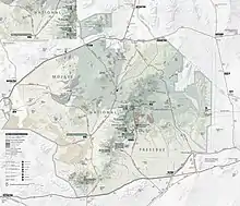
Kelso Wash is an ephemeral stream[1] in San Bernardino County,[2] California, United States, that drains into Soda Lake (Hewett 1956, p. 6). The town of Kelso lies southeast of the wash (Muhs, Lancaster & Skipp 2017, p. 227).
Kelso Wash lies within the Mojave National Preserve. It originates at Cima,[3] between the Kelso Mountains to the west and the Providence Mountains to the east as a southward flowing wash (Muhs, Lancaster & Skipp 2017, p. 224), where it receives the Cedar Wash from northeast and washes draining the Marl Mountains from northwest.[3] The Cima Dome lies nearby.[1] The area of Cima separates its valley from Ivanpah Valley (Hewett 1956, p. 9). It then turns west north of the Kelso Dunes(Muhs, Lancaster & Skipp 2017, p. 224) and receives first the Cottonwood Wash from southeast, which drains the southern Providence Mountains and the Granite Mountains (Muhs, Lancaster & Skipp 2017, p. 226), and then the Budweiser Wash from the south, which drains the Bristol Mountains, Granite Mountains and Old Dad Mountains. Kelso Wash then passes northwestward between Devils Playground to the north and Bristol Mountains to the south. It eventually ends into Soda Lake (Muhs, Lancaster & Skipp 2017, p. 224). It is the largest wash draining the area of Soda Lake.[1]
Precipitation in the area averages about 100–200 millimetres (4–8 in). Groundwater close to the surface and runoff sustain Kelso Wash.[2] Dunes frequently blocked its course, impounding temporary lakes that filled with sediments during the early Holocene.(Sweeney et al. 2020, p. 2328) The wash has cut as deep as 11 metres (36 ft) into the ground, and its course is flanked by river terraces.(Sweeney et al. 2020, p. 2318) The Union Pacific Railroad closely parallels the wash (Ramsey et al. 1999, p. 661).
Together with the Mojave River, it supplies water to the Mojave River sink area and Lake Tuendae (Hanrahan, Gibani & Miller 2008, p. 335). In 1984 Kelso Wash was proposed to be part of the source of sand for the Kelso Dunes (Muhs, Lancaster & Skipp 2017, p. 223).
References
- 1 2 3 Wells, Stephen G.; Brown, William J.; Enzel, Yehouda; Anderson, Roger Y.; McFadden, Leslie D. (2003-01-01). Late Quaternary geology and paleohydrology of pluvial Lake Mojave, southern California. Vol. 368. p. 81. doi:10.1130/0-8137-2368-X.79. ISBN 978-0-8137-2368-6. ISSN 0072-1077.
{{cite book}}:|journal=ignored (help) - 1 2 "Kelso Valley Groundwater Basin" (PDF). www.water.ca.gov/. 27 February 2004.
- 1 2 "MOJAMap" (PDF). nps.gov.
- Hanrahan, Grady; Gibani, Siraj; Miller, Kent (2008-10-01). "Multivariate chemometrical classification and assessment of Lake Tuendae: A Mojave desert aquatic environment housing the endangered Mojave Tui Chub". Ecological Informatics. 3 (4–5): 335. doi:10.1016/j.ecoinf.2008.09.003.
- Hewett, Donnel Foster (1956-01-01). Geology and Mineral Resources of the Ivanpah Quadrangle, California and Nevada. U.S. Government Printing Office.
- Muhs, Daniel R.; Lancaster, Nicholas; Skipp, Gary L. (2017-01-01). "A complex origin for the Kelso Dunes, Mojave National Preserve, California, USA: A case study using a simple geochemical method with global applications". Geomorphology. 276: 222–243. Bibcode:2017Geomo.276..222M. doi:10.1016/j.geomorph.2016.10.002.
- Ramsey, Michael S.; Christensen, Philip R.; Lancaster, Nicholas; Howard, Douglas A. (1999-05-01). "Identification of sand sources and transport pathways at the Kelso Dunes, California, using thermal infrared remote sensing". Geological Society of America Bulletin. 111 (5): 646–662. doi:10.1130/0016-7606(1999)111<0646:IOSSAT>2.3.CO;2. ISSN 0016-7606.
- Sweeney, Mark R.; McDonald, Eric V.; Chabela, Lucas P.; Hanson, Paul R. (2020-11-01). "The role of eolian-fluvial interactions and dune dams in landscape change, late Pleistocene–Holocene, Mojave Desert, USA". GSA Bulletin. 132 (11–12): 2318–2332. doi:10.1130/B35434.1. ISSN 0016-7606. S2CID 216425755.