Katlijk
Ketlik | |
|---|---|
Village | |
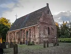
 St Thomas' church | |
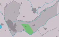
 Location in the Heerenveen municipality | |
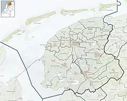
 Katlijk Location in the Netherlands  Katlijk Katlijk (Netherlands) | |
| Coordinates: 52°56′48″N 6°0′46″E / 52.94667°N 6.01278°E | |
| Country | |
| Province | |
| Municipality | |
| Area | |
| • Total | 11.37 km2 (4.39 sq mi) |
| Elevation | 2 m (7 ft) |
| Population (2021)[1] | |
| • Total | 585 |
| • Density | 51/km2 (130/sq mi) |
| Postal code | 8455[1] |
| Dialing code | 0513 |
Katlijk (West Frisian: Ketlik) is a village in Heerenveen in the province of Friesland, the Netherlands. It had a population of around 610 in 2017.[3]
History
The village was first mentioned in 1315 as Kathaleke. The etymology is unclear.[4] The village had a chapel as early as 1254. In 1525, a church without tower was built. The double bell tower has been restored in 1930. In 1840, Katlijk was home to 241 people.[5]
Before 1934, Katlijk was part of the Schoterland municipality.[5]
Gallery
 't Slotsje
 Belfry Katlijk
 Youth camp Katlijk (1948)
References
- 1 2 3 "Kerncijfers wijken en buurten 2021". Central Bureau of Statistics. Retrieved 30 March 2022.
- ↑ "Postcodetool for 8455JA". Actueel Hoogtebestand Nederland (in Dutch). Het Waterschapshuis. Retrieved 30 March 2022.
- ↑ Kerncijfers wijken en buurten 2017 - CBS Statline
- ↑ "Katlijk - (geografische naam)". Etymologiebank (in Dutch). Retrieved 30 March 2022.
- 1 2 "Katlijk". Plaatsengids (in Dutch). Retrieved 30 March 2022.
External links
![]() Media related to Katlijk at Wikimedia Commons
Media related to Katlijk at Wikimedia Commons
This article is issued from Wikipedia. The text is licensed under Creative Commons - Attribution - Sharealike. Additional terms may apply for the media files.