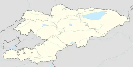
Kara-Kulja | |
|---|---|
 Kara-Kulja | |
| Coordinates: 40°38′00″N 73°35′33″E / 40.63333°N 73.59250°E | |
| Country | Kyrgyzstan |
| Region | Osh Region |
| District | Kara-Kulja District |
| Elevation | 1,390 m (4,560 ft) |
| Population (2021) | |
| • Total | 15,616 |
| Time zone | UTC+6 |
Kara-Kulja (Kyrgyz: Кара-Кулжа, قارا-قۇلجا; Russian: Кара-Кульджа, Kara-Kul’dzha) is the center of Kara-Kulja District in Osh Region of Kyrgyzstan.[1]
It is located in the mountain valley of the river Kara Darya, southeast and upstream from Uzgen. Its population was 15,616 in 2021.[2]
Population
| Year | Pop. | ±% p.a. |
|---|---|---|
| 2009 | 11,794 | — |
| 2021 | 15,616 | +2.37% |
| Note: resident population; Sources:[2][3] | ||
Climate
Kara-Kulja has a hot, dry-summer continental climate (Köppen climate classification Dsa). There is more rainfall in winter than in summer. The average annual temperature in Kara-Kulja is 9.4 °C (48.9 °F). About 527 mm (20.75 in) of precipitation falls annually.
| Climate data for Kara-Kulja | |||||||||||||
|---|---|---|---|---|---|---|---|---|---|---|---|---|---|
| Month | Jan | Feb | Mar | Apr | May | Jun | Jul | Aug | Sep | Oct | Nov | Dec | Year |
| Mean daily maximum °C (°F) | −1.5 (29.3) |
1.3 (34.3) |
9.0 (48.2) |
17.9 (64.2) |
23.0 (73.4) |
27.7 (81.9) |
30.1 (86.2) |
29.0 (84.2) |
24.4 (75.9) |
17.1 (62.8) |
8.2 (46.8) |
0.8 (33.4) |
15.6 (60.0) |
| Mean daily minimum °C (°F) | −11.4 (11.5) |
−8.6 (16.5) |
−1.2 (29.8) |
5.9 (42.6) |
10.2 (50.4) |
13.5 (56.3) |
15.5 (59.9) |
14.0 (57.2) |
9.1 (48.4) |
3.3 (37.9) |
−2.8 (27.0) |
−7.9 (17.8) |
3.3 (37.9) |
| Average precipitation mm (inches) | 32 (1.3) |
39 (1.5) |
62 (2.4) |
82 (3.2) |
87 (3.4) |
50 (2.0) |
30 (1.2) |
14 (0.6) |
18 (0.7) |
48 (1.9) |
36 (1.4) |
29 (1.1) |
527 (20.7) |
| Source: Climate-Data.org,Climate data | |||||||||||||
References
- ↑ "Classification system of territorial units of the Kyrgyz Republic" (in Kyrgyz). National Statistics Committee of the Kyrgyz Republic. May 2021. pp. 57–59.
- 1 2 "Population of regions, districts, towns, urban-type settlements, rural communities and villages of Kyrgyz Republic" (XLS) (in Russian). National Statistics Committee of the Kyrgyz Republic. 2021. Archived from the original on 10 November 2021.
- ↑ "2009 population and housing census of the Kyrgyz Republic: Osh Region" (PDF) (in Russian). National Statistics Committee of the Kyrgyz Republic. 2010. p. 217.
This article is issued from Wikipedia. The text is licensed under Creative Commons - Attribution - Sharealike. Additional terms may apply for the media files.
