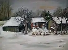
Kanna | |
|---|---|
Village | |
 Kanna | |
| Coordinates: 50°17′N 20°53′E / 50.283°N 20.883°E | |
| Country | |
| Voivodeship | Lesser Poland |
| County | Dąbrowa |
| Gmina | Bolesław |
| Area | 462 ha (1,142 acres) |
Kanna [ˈkanna] is a village in the administrative district of Gmina Bolesław, within Dąbrowa County, Lesser Poland Voivodeship, in southern Poland.[1]
Geography
It lies approximately 3 kilometres (2 mi) west of Bolesław, 15 km (9 mi) north-west of Dąbrowa Tarnowska, and 80 km (50 mi) east of the regional capital Kraków.
It is in the north-eastern end of the Malopolska province, in the bend of the Wisła River in front of the mouth of Nida.

Fauna
Many animals call the village home, including; badger, marten, European pine marten, weasel, boar, moose, deer and beavers. Additionally, Hamster European can be found, a legally protected animal. The birds include the Accipitrinae, common raven, goldfinch, lesser spotted eagle, common kestrel necked, tern, northern lapwing, cormorant, corncrake and woodpecker, Eurasian eagle-owl or buzzard.
Climate
Climate areas belonging to the Sandomierz Basin are among the warmest in Poland. The average temperature inJuly is above 19 °C, average January -30 °C. The growing season is around 220 days, with annual rainfall of 600 – 700 mm.
Culture
Aa brick chapel of Our Lady of the Rosary was built in 1871. Its baroque-shaped signature tower rises high above the roofs of the village. The chapel was restored in 2007.
People work in the Song and Dance Ensemble.
The village hosts a playground.
A Volunteer Fire Department is located in the House of the People.
Transport
Microbus private lines and a buses provide transport.
The village can be reached from Cracow and Sandomierz by national ![]() DK 79. The ferry Nowy Korczyn/Borusowa crosses the Wisła. Provincial road
DK 79. The ferry Nowy Korczyn/Borusowa crosses the Wisła. Provincial road ![]() DW 973 connects with Żabno Szczucin.
DW 973 connects with Żabno Szczucin.
Demographics
The villages hosts75 households. 13% work exclusively on farms, 80% farm + earn non-agricultural wages, and the remaining 7% are mainly non-agricultural wages and other income sources.[2]