Kanō-juku 加納宿 | |
|---|---|
| post station | |
 Hiroshige's print of Kanō-juku, part of the Sixty-nine Stations of the Kiso Kaidō series | |
| General information | |
| Location | Gifu Gifu Prefecture (former Mino Province) Japan |
| Coordinates | 35°24′20″N 136°45′34″E / 35.40556°N 136.75944°E |
| Elevation | 14 meters |
| Line(s) | Nakasendō |
| Distance | 412.8 km from Edo |
| Location | |
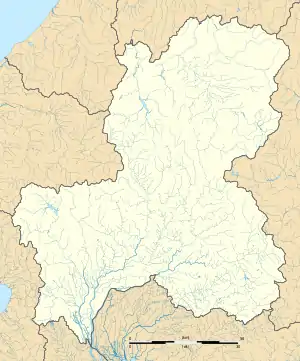
 Kanō-juku Location within Gifu Prefecture  Kanō-juku Kanō-juku (Japan) | |

Kanō-juku (加納宿, Kanō-juku) was the fifty-third of the was the fifty-eighth of the sixty-nine stations of the Nakasendō connecting Edo with Kyoto in Edo period Japan. It is located in former Mino Province in what is now part of the city of Gifu, Gifu Prefecture, Japan.[1][2][3]
History
Kanō-juku is located just south of JR Gifu Station in Japan, and was a castle town for Kanō Castle. The first construction of Kanō Castle began in 1445 by Saitō Toshinaga, who was a vassal of the Toki clan; however, this castle was abandoned by 1538. Following the Battle of Sekigahara, the victorious Tokugawa Ieyasu awarded Gifu Castle to his son-in-law, Okudaira Nobumasa. However, due to its poor state of repair, Nobumasa decided to abolish Gifu Castle and to relocate to a new castle built on the site of the old Kanō Castle. This new structure was completed in 1603 in record time, as Ieyasu had ordered various daimyō to contribute materials, labor and money for its construction, and the largest three-story yagura was transferred from Gifu Castle to be its tenshu.[4] The design of the castle was also kept simple, with a minimal number of towers, as the castle was being constructed as a center of local administration in peacetime.
Per the 1843 "中山道宿村大概帳" (Nakasendō Shukuson Taigaichō) guidebook issued by the Inspector of Highways (道中奉行, Dōchu-būgyō), the town had a population of 2728 people in 805 houses, including one honjin, one waki-honjin, and 35 hatago. It extended for approximately 2.3 km (1.4 mi) along the highway,[5] making it the largest post town in Mino Province. The town was noted for its production of washi (Japanese paper). It is located 412.8 kilometers from Edo. During the Bakumatsu period, Princess Kazu-no-miya stayed at the honjin in Kanō-juku in 1861 en route to marry Shogun Tokugawa Iemochi in Edo.
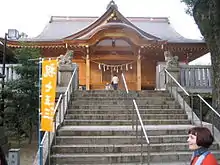
The 1891 Mino–Owari earthquake and the 1945 Bombing of Gifu in World War II destroyed all of the old buildings at Kanō-juku, with the exception of some structures of the Kanō Tenman-gū, which had originally been built to serve as a place of worship for the castle's residents .
Kanō-juku in The Sixty-nine Stations of the Kiso Kaidō
Utagawa Hiroshige's ukiyo-e print of Kanō-juku dates from 1835 -1838. The print depicts a daimyō procession on sankin kōtai departing Kanō Castle at dawn. The tenshu of Kanō Castle had burned down in 1728 and was never rebuilt, and Hiroshige depicts the castle accurately with low stone walls and a corner yagura watchtower. The road is lined with pine trees, and the kago containing the daimyō himself can just be seen at the far right side of the composition.
Neighboring post towns
- Nakasendō
- Unuma-juku - Kanō-juku - Gōdo-juku
- (Shinkanō-juku was an ai no shuku located between Unuma-juku and Kanō-juku.)
Notes
- ↑ Nakasendo to Shukuba-machi Archived 2007-08-13 at the Wayback Machine. Gifu City Hall. Accessed September 9, 2007.
- ↑ "株式会社イビソク | 総合建設コンサルタント 総合文化財コンサルタント 空間データ基盤整備 機材レンタル・企画展示". Retrieved 2020-02-13.
- ↑ Kanō-juku
- ↑ Gifu City Walking Map. Gifu Lively City Public Corporation, 2007.
- ↑ Gifu City Walking Map. Gifu Lively City Public Corporation, 2007.
References
- Izzard, Sebastian (2008). The Sixty-Nine Stations of the Kisokaido. George Braziller. ISBN 0807615935.
- Berna, Cristina (2019). Hiroshige 69 Stations of the Nakasendō. Missys Clan. ISBN 2919787667.
- Kishimoto, Yutaka (2016). 中山道浪漫の旅 書き込み手帖. Shinano Mainichi Shimbun. ISBN 4784072977. (in Japanese)
- Yagi, Makio (2014). ちゃんと歩ける中山道六十九次 西 藪原宿~京三条大橋. 山と渓谷社. ISBN 4635600785. (in Japanese)