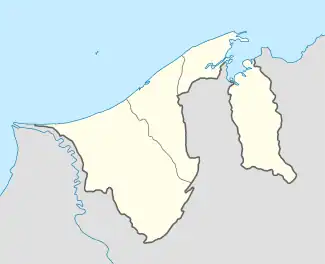
Kampong Katok | |
|---|---|
 Location in Brunei | |
| Coordinates: 4°54′54″N 114°53′34″E / 4.915°N 114.8927°E | |
| Country | Brunei |
| District | Brunei-Muara |
| Mukim | Gadong 'A' |
| Population (2016)[1] | |
| • Total | 2,079 |
| Time zone | UTC+8 (BNT) |
| Postcode | BE2319 |
Kampong Katok is a village in Brunei-Muara District, Brunei, about 8 kilometres (5.0 mi) from the capital Bandar Seri Begawan. The population was 2,079 in 2016.[1] It is one of the villages within Mukim Gadong 'A'. The postcode is BE2319.[2]
Geography
The village is located on the outskirts of the municipal area of the country's capital Bandar Seri Begawan, and about 8 kilometres (5.0 mi) from its city centre.
As a village subdivision, it borders Kampong Tungku and STKRJ Katok 'A' to the north, STKRJ Tungku Area 1 to the north-east, Kampong Mata-Mata to the east and south, Area 2 of STKRJ Mata-Mata to the south, Kampong Tanjong Bunut to the south-west, Kampong Selayun to the west, and Kampong Peninjau to the north-west.[3]
Administration
Kampong Katok shares a village head (ketua kampung) with the neighbouring village Kampong Tungku.[4]
Economy
Efforts made by the residents of Kampong Tungku and Katok through animal husbandry or more precisely producing kelulut honey. The production of kelulut honey is planned to be the brand of the village's product, especially in response to the government's call to make one product one village, given the growing involvement of the population and their liking for it. The Ketua Kampong Tungku/Katok explained that, seeing the development through animal husbandry, the members of the Village Consultative Council (MPK) suggested that it be made a trademark of the village's product and it was well received.[5]
Address
The location address for the public housing estates STKRJ Katok 'A' and STKRJ Katok 'B', as well as the schools Katok Secondary School and Raja Isteri Pengiran Anak Hajah Saleha Girls' Arabic Religious Secondary School which are located in STKRJ Katok 'B', is often regarded as located in the village, even though they are not within the village boundary. The aforementioned public housing estates are designated as separate village subdivisions.
References
- 1 2 "Population and Housing Census Update Final Report 2016" (PDF). www.deps.gov.bn. Department of Statistics. December 2018. Retrieved 26 July 2021.
- ↑ "Buku Poskod Edisi Kedua (Kemaskini 26 Disember 2018)" (PDF). post.gov.bn (in Malay). Brunei Postal Services Department. 26 December 2018. Retrieved 26 July 2021.
- ↑ Brunei Darussalam street directory : quick & easy reference maps., Brunei Press Sdn. Bhd., 2014, pp. 60–61 & 72–73, ISBN 9789991732411, OCLC 932264901
- ↑ "Pineapple Farming, Provides Job Opportunities For Youths". Brudirect.com. 4 June 2020. Retrieved 26 July 2021.
- ↑ KOMPILASI RENCANA KNK 2015 (PDF) (in Malay). Kenali Negera Kitani. 2015. pp. 204–209.