Kal | |
|---|---|
 | |
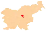
 Kal Location in Slovenia | |
| Coordinates: 46°6′55.07″N 14°57′9.73″E / 46.1152972°N 14.9527028°E | |
| Country | |
| Traditional region | Styria |
| Statistical region | Central Sava |
| Municipality | Zagorje ob Savi |
| Area | |
| • Total | 0.7 km2 (0.3 sq mi) |
| Elevation | 680 m (2,230 ft) |
| Population (2015)[1] | |
| • Total | 100 |
Kal (pronounced [ˈkaːl]) is a settlement in the hills west of Zagorje ob Savi in central Slovenia. The area is part of the traditional region of Styria. It is now included with the rest of the Municipality of Zagorje ob Savi in the Central Sava Statistical Region.[2]
History
Kal was a separate village until 1953, when, together with Vodice, it was annexed by Jablana.[3] Kal became an independent settlement again in 2000, when it was separated from Jablana. Further territorial adjustment was made in 2001, when Kal annexed part of the territory of Požarje.[1]
References
- 1 2 3 Statistical Office of the Republic of Slovenia: Kal, Zagorje ob Savi.
- ↑ Zagorje ob Savi municipal site Archived 2012-03-06 at the Wayback Machine
- ↑ Marinković, Dragan (1991). Abecedni spisak naselja u SFRJ. Promene u sastavu i nazivima naselja za period 1948–1990. Belgrade: Savezni zavod za statistiku. pp. 44, 46.
External links
 Media related to Kal at Wikimedia Commons
- Kal on Geopedia
This article is issued from Wikipedia. The text is licensed under Creative Commons - Attribution - Sharealike. Additional terms may apply for the media files.
