Kajjansi Airfield | |||||||||||
|---|---|---|---|---|---|---|---|---|---|---|---|
 | |||||||||||
| Summary | |||||||||||
| Airport type | Private & civilian | ||||||||||
| Owner | Aviation Communication and Logistics Services | ||||||||||
| Operator | Mission Aviation Fellowship | ||||||||||
| Location | Kajjansi, Uganda | ||||||||||
| Elevation AMSL | 3,743 ft / 1,141 m | ||||||||||
| Coordinates | 00°12′01″N 32°33′00″E / 0.20028°N 32.55000°E | ||||||||||
| Map | |||||||||||
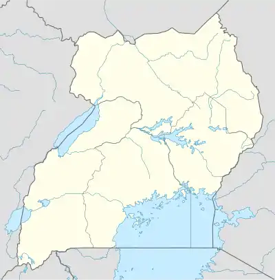
 HUKJ Location of Kajjansi Airfield in Uganda | |||||||||||
| Runways | |||||||||||
| |||||||||||
Kajjansi Airfield (IATA: KJJ, ICAO: HUKJ) is an airfield serving Kajjansi, a town in the Central Region of Uganda.[1]
Location
The airfield is approximately 29 kilometres (18 mi), by road, north-east of Entebbe International Airport, Uganda's largest airport,[2] and 17 kilometres (11 mi) south of the central business district of Kampala, Uganda's capital and largest city.[3] The geographical location of the airfield are:0°12'01.0"N, 32°33'00.0"E (Latitude:0.200278; Longitude:32.550000).[4] Kajjansi Airfield sits at an elevation of 1,141 metres (3,743 ft) above mean sea level.[1] Kajjansi is located in the southern portion of the Kampala conurbation. The airport has one unpaved runway 14/32, which is 1,150 metres (3,773 ft) long.[5] The runway is east of the Kampala–Entebbe Road, bordering marshland near the shore of Lake Victoria.[4]

Ownership
The airfield is owned by Aviation Communication and Logistics Services (ACLS), and operated by Mission Aviation Fellowship (MAF) an international Christian humanitarian relief and development organisation. In the mid-2010s, the Christian engineering charity Engineering Ministries International (EMI) redeveloped the office building of the airfield. The new office building became the headquarters of both MAF Uganda and EMI East Africa.[6]
Operations
Kajjansi Airfield is also the operations base for Kampala Aeroclub and Flight Training Centre (KAFTC). The company operates scheduled and charter tours to three of Uganda's national parks; Murchison Falls National Park, Queen Elizabeth National Park and Bwindi National Park.[7]
The same company maintains an ICAO-recognized flight-training school that trains, tests and awards private pilots licenses. The school is sometimes referred to as Kajjansi Flying School.[8][9] KAFTC also operates an aircraft maintenance facility at this airport, under the name of Kampala Aero Maintenance.[8]
Other considerations
Kajjansi Airfield is also the operations base for Pangea Aviation Academy, a flight instructions academy that focuses on training pilots destined for service with the Government of Uganda, including in the UPDF Air Force, the Uganda Police Air Wing, Uganda National Airlines Company and with General Aviation, in the country and the region.[10]
See also
References
- 1 2 Our Airport (20 December 2014). "Profile of Kajjansi Airfield". Ourairports.com. Retrieved 1 June 2020.
- ↑ Google (1 June 2020). "Road Distance Between Entebbe Airport and Kajjansi Airfield in Uganda" (Map). Google Maps. Google. Retrieved 1 June 2020.
- ↑ Google (1 June 2020). "Distance Between Kampala Central Business District and Kajjansi Airfield" (Map). Google Maps. Google. Retrieved 1 June 2020.
- 1 2 Google (1 June 2020). "Location of Kajjansi Airfield" (Map). Google Maps. Google. Retrieved 1 June 2020.
- ↑ Business Air News (1 June 2020). "Kajjansi Airfield: Length of Runway". Businessairnews.com. Retrieved 1 June 2020.
{{cite web}}:|author=has generic name (help) - ↑ EMI Uganda (1 June 2020). "About EMI Uganda". Kajjansi: Engineering Ministries International. Retrieved 1 June 2020.
- ↑ Fly Uganda (1 June 2020). "About Kampala Aeroclub and Flight Training Centre". Kajjansi: Flyuganda.com. Retrieved 1 June 2020.
- 1 2 Schoolnet Uganda (1 June 2020). "About Kajjansi Flying School". Schoolnetuganda.com. Retrieved 1 June 2020.
- ↑ Find Glocal (1 June 2020). "Details About Fly Uganda - Kampala Aero Club". Findglocal.com. Retrieved 1 June 2020.
- ↑ Lawrence Mulondo (29 April 2019). "Minister Azuba Calls On Ugandans To Join Aviation". New Vision. Kampala. Retrieved 1 June 2020.
