Kailari Rural Municipality
कैलारी गाउँपालिका | |
|---|---|
 Kailari Rural Municipality Location in Nepal  Kailari Rural Municipality Kailari Rural Municipality (Nepal) | |
| Coordinates: 28°34′N 80°49′E / 28.57°N 80.82°E | |
| Country | |
| Province | Sudurpashchim Province |
| District | Kailali District |
| Government | |
| • Chairperson | Laju Ram Chaudhary (NCP) |
| • Vice-chairperson | Laxmi Satgauwa (NCP) |
| Area | |
| • Total | 233 km2 (90 sq mi) |
| Population (2011) | |
| • Total | 47,987 |
| • Rank | 6th (Nepal) |
| • Density | 210/km2 (530/sq mi) |
| Time zone | UTC+5:45 (Nepal Time) |
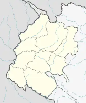
Kailari is a rural Municipality in Kailali District in Sudurpashchim Province of Nepal.[1] It is surrounded by Bajani Municipality In the East , Dhangadhi Sub Metropolitan City in the West , Gauriganga Municipality and Ghodaghodi Municipality in the North and Uttar Pradesh , India in the South.
Demographics
At the time of the 2011 Nepal census, Kailari Rural Municipality had a population of 47,987. Of these, 88.5% spoke Tharu, 5.5% Nepali, 2.8% Doteli, 1.4% Achhami, 1.0% Maithili, 0.2% Bajhangi, 0.2% Bhojpuri, 0.1% Baitadeli, 0.1% Darchuleli, 0.1% Newar, 0.1% Sign language, 0.1% Urdu and 0.1% other languages as their first language.[2]
In terms of ethnicity/caste, 89.3% were Tharu, 3.5% Chhetri, 2.5% Kami, 1.9% Hill Brahmin, 0.5% other Dalit, 0.5% Damai/Dholi, 0.5% Magar, 0.4% Thakuri, 0.2% Sarki, 0.1% Badi, 0.1% Lohar, 0.1% Musalman, 0.1% Newar, 0.1% Rajbanshi and 0.1% others.[3]
In terms of religion, 97.6% were Hindu, 2.2% Christian, 0.1% Buddhist, 0.1% Muslim and 0.1% others.[4]
In terms of literacy, 62.9% could read and write, 2.0% could only read and 35.2% could neither read nor write.[5]
