77  | |
|---|---|
| Jayu Motorway 자유로 | |
| Route information | |
| Length | 49.967 km (31.048 mi) |
| Existed | 1992–present |
| Major junctions | |
| South end | |
| North end | |
| Location | |
| Country | South Korea |
| Highway system | |


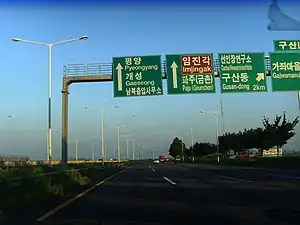
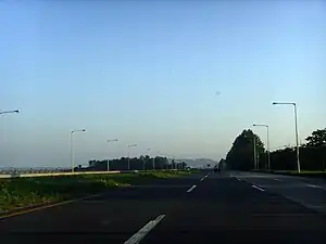
The Jayu Motorway (also called Jayu-ro, Korean: 자유로, lit. Freedom Road) is a major north–south arterial highway in South Korea. Its southern terminus is in Seoul, while its northern terminus is at National Route 1's Reunification Bridge leading into the DMZ. North Korea is visible from a section of the highway stretching from Seongdong-ri to Ogeum-ri. Its shape closely parallels the northern bank of the Han River and is heavily fortified with barbed wire and military observatories. It is part of National Route 77.
This route connects Seoul (Gayang Bridge), Goyang (Ilsan) to Paju (Munsan, Panmunjeom), with a total length of 49.976 km (31.054 mi).
The highway is directly connected with the Gangbyeonbuk-ro at Gayang Bridge.
History
- May 19, 1990 - Construction Begin
- August, 1992 - Haengju Bridge~Tongil observatory section(29 km) opens to traffic.
- September, 1994 - Tongil observatory~Jayu Bridge(자유의다리) section(17.5 km) opens to traffic.
Compositions
Lanes
- Dangdong IC ~ Jayu IC: 4
- Nakha IC - Dangdong IC: 6
- Nakha IC - Isanpo JC: 8
- Gayang Bridge - Isanpo JC: 10
Length
49.976 km (31.054 mi)
Speed limits
- 90 km/h
List of facilities
- IC: Interchange, JC: Junction, SA: Service Area, TG:Tollgate
| No. | Name | Korean Name | Hanja Name | Connections | Notes | Location | |
|---|---|---|---|---|---|---|---|
| Connected directly with | |||||||
| 6 | Gayang Br. IC | 가양대교북단 | 加陽大橋 | Gayang-daero (가양대로) Hwagok-ro(화곡로) | Highway Start Spot | Mapo | Seoul |
| 5 | S. Goyang IC | 남고양나들목 | 南高陽나들목 | (Branch Line) | Goyang | Gyeonggi | |
| 1 | Bungno JC (Banghwa Bridge) | 북로분기점 | 北路分岐點 | ||||
| IC | Haengju IC | 행주나들목 | 幸州나들목 | Haengju-ro (행주로) | Seoul-bound Only | ||
| JC | Haengju JC (Haengju Bridge) | 행주분기점 | 幸州分岐點 | KTX Haengsin Station | |||
| JC | Jayuro JC (Gimpo Bridge) | 자유로분기점 | 自由路分岐點 | ||||
| IC | Janghang IC | 장항나들목 | 獐項나들목 | Baengma-ro (백마로) Ilsan Lake Park | |||
| IC | KINTEX IC | 킨텍스나들목 | KINTEX나들목 | KINTEX-ro (킨텍스로) KINTEX | |||
| JC | Isanpo JC (Ilsan Bridge) | 이산포분기점 | 二山浦分岐點 | Provincial Route 98 Goyang Stadium Daehwa Station | |||
| IC | Gusan IC | 구산나들목 | 九山나들목 | Provincial Route 356 | |||
| IC | Jangwol IC | 장월나들목 | 長月나들목 | Provincial Route 358 Paju Book City | |||
| IC | Munbal IC | 문발나들목 | 文發나들목 | Provincial Route 56 | Paju | ||
| IC | Seongdong IC | 성동나들목 | 城洞나들목 | Provincial Route 360 | |||
| IC | Nakha IC | 낙하나들목 | 洛下나들목 | Provincial Route 366 | |||
| IC | Naepo IC | 내포나들목 | 內浦나들목 | ||||
| IC | Dangdong IC | 당동나들목 | 堂洞나들목 | ||||
| IC | Imjingak IC | 임진각나들목 | 任津閣나들목 | Imjingak Imjingak Station | |||
| IC | Jayu IC | 자유나들목 | 自由나들목 | (Tongil-ro / 통일로) Panmunjeom Kaesong Industrial Region Reunification Highway | |||
Jayuro Ghost
The highway is also notable for its variant of the vanishing hitchhiker called the Jayuro Ghost. The area frequently experiences foggy weather and thus has a high rate of automobile collisions. According to the narrative, a woman can sometimes be seen along the side of the road wearing sunglasses. Upon closer inspection it is revealed that the so-called sunglasses are actually the woman's gouged-out eyes. Another version of the narrative has a driver picking up the ghost, only for the ghost to direct the driver to a cemetery or disappear when the driver reaches the destination. The Dark Side of Seoul Podcast released a video episode about this urban legend and other road-related Korean folklore.[1]
See also
- List of streets in Seoul
- Olympicdaero
- Gimpo Hangang Highway