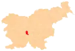
Iška Vas | |
|---|---|
Village | |
 | |
 Iška Vas Location in Slovenia | |
| Coordinates: 45°56′22.49″N 14°30′45.45″E / 45.9395806°N 14.5126250°E | |
| Country | |
| Traditional region | Inner Carniola |
| Statistical region | Central Slovenia |
| Municipality | Ig |
| Area | |
| • Total | 1.86 km2 (0.72 sq mi) |
| Elevation | 325.3 m (1,067.3 ft) |
| Population (2002) | |
| • Total | 356 |
| [1] | |
Iška Vas (pronounced [ˈiːʃka ˈʋaːs]; Slovene: Iška vas, German: Iggdorf[2]) is a village on the right bank of the Iška River in the Municipality of Ig in central Slovenia, just south of the capital Ljubljana. The entire municipality is part of the traditional region of Inner Carniola and is now included in the Central Slovenia Statistical Region.[3]
Name
The name Iška vas literally means 'village in the Ig region', derived from the adjective form *Ižьska(ja). The settlement was attested in written sources in 1352 as in der Eysch, and in 1484 as dorff Aisch.[4] In the past the German name was Iggdorf.[2]
Churches
There are two churches in the settlement. To the east of the main settlement core is the church dedicated to Saint Michael. It was first mentioned in written documents dating to the early 14th century and contains 16th-century frescos and a lapidarium of mostly Roman tombstones. The second church is built on a slight hill north of the settlement. It is dedicated to the Holy Cross. Both belong to the Parish of Ig.[5]
Gallery
.jpg.webp) Iška Vas, ca. 1928–1947
Iška Vas, ca. 1928–1947
References
- ↑ Statistical Office of the Republic of Slovenia
- 1 2 Leksikon občin kraljestev in dežel zastopanih v državnem zboru, vol. 6: Kranjsko. 1906. Vienna: C. Kr. Dvorna in Državna Tiskarna, p. 108.
- ↑ Ig municipal site
- ↑ Snoj, Marko (2009). Etimološki slovar slovenskih zemljepisnih imen. Ljubljana: Modrijan. pp. 167–168.
- ↑ Slovenian Ministry of Culture register of national heritage reference numbers ešd 1851 & 2763
External links
 Media related to Iška Vas at Wikimedia Commons
- Iška Vas on Geopedia
