Hubyn
Гу́бин | |
|---|---|
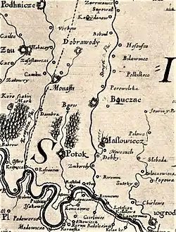
 Map of Dniester River area, 1650 | |
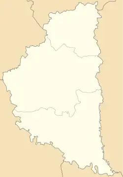
 Hubyn Location of Hubyn in Ternopil Oblast  Hubyn Location of in Ukraine | |
| Coordinates: 48°50′50″N 25°25′19″E / 48.84722°N 25.42194°E | |
| Country | |
| Oblast | |
| Raion | Chortkiv Raion |
| Hromada | Zolotyi Potik settlement hromada |
| Area | |
| • Total | 4.27 km2 (1.65 sq mi) |
| Population | |
| • Total | 140 |
| • Density | 32.8/km2 (85/sq mi) |
| Time zone | UTC+2 (EET) |
| • Summer (DST) | UTC+3 (EEST) |
| Postal code | 48466[1] |
| Area code | +380 3544 |
Hubyn (uk. Гу́бин) is a Ukrainian village in the Zolotyi Potik settlement hromada, in the Chortkiv Raion, of the Ternopil Oblast.[2] It is located on the Dniester River.
Since September 2015, it has been a part of the Zolotyi Potik hromada.[3]
In accordance with the Cabinet of Ministers of Ukraine, the village became part of the Zolotyi Potik settlement hromada.[4]
History
Near Hubyn, archaeological sites of the Upper Paleoolithic, spherical amphorae, and ancient Russian artifcacts were discovered. An ancient Russian settlement was found on the banks of the Dniester.[5] The first written mention of the city was in 1560.
In the 1930s, the population of Hubyn exceeded 1,200 people. Ukrainians consisted 80% of the population, Jews consisted another 15%, and another 5% were made up of various other ethnic groups such as Russians and Poles. After World War II, the population fell to 450 people. Many residents died from conflict between the USSR and Nazi Germany. In modern times, around 150 people live in the village.
In 1990, the Ternopil Oblast Council restored Hubyn's status as an official village, separating it from the full jurisdiction of the Buchach district.[6]

Geography and ecology
The village is located on the left bank of the Dniester.
In November of 2018, the Department of the State Agency of Fisheries in Ternopil banned fishing in the region during the winter season to give time for the local population to replenish to avoid overconsumption.[7]
Church
The Church of the Truncation of the Head of St. John the Baptism (Hubyn) is the local parish in Hubyn. It was built on the site of an older wooden church, which burned down in 1835. The church was consecrated in 1863. The building is also wooden, and was built with spruce logs on top of oak foundations.

References
- ↑ "Поштовий індекс Губин село, Чортківський район, Тернопільська область". Поштові індекси України - Postcode.in.ua. Retrieved 2023-04-03.
- ↑ "Тернопільщину поділили на 6 зон. «Тернопільобленерго» оновив графік світла". ПОГЛЯД (in Ukrainian). 2023-02-10. Retrieved 2023-04-03.
- ↑ "ЧОРТКІВСЬКИЙ РАЙОН | Тернопільська область". Тернопільщина (in Ukrainian). Retrieved 2023-04-03.
- ↑ Order of the Cabinet of Ministers of Ukraine dated June 12, 2020 No. 724-p "On the definition of administrative centers and the approval of the territories of territorial communities of the Ternopil region"
- ↑ "Археологія та стародавня історія Бучацького району". www.zamky.com.ua. Retrieved 2023-03-27.
- ↑ "Губин с". www.pslava.info. Retrieved 2023-04-03.
- ↑ "Із 1 листопада на Тернопільщині заборонили ловити рибу в зимувальних ямах". Провсе (in Ukrainian). 2018-10-30. Retrieved 2023-04-03.