Hostišová | |
|---|---|
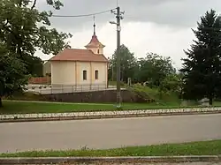
 Centre of Hostišová with a chapel | |
 Flag  Coat of arms | |
 Hostišová Location in the Czech Republic | |
| Coordinates: 49°15′13″N 17°35′28″E / 49.25361°N 17.59111°E | |
| Country | |
| Region | Zlín |
| District | Zlín |
| First mentioned | 1397 |
| Area | |
| • Total | 2.65 km2 (1.02 sq mi) |
| Elevation | 308 m (1,010 ft) |
| Population (2023-01-01)[1] | |
| • Total | 565 |
| • Density | 210/km2 (550/sq mi) |
| Time zone | UTC+1 (CET) |
| • Summer (DST) | UTC+2 (CEST) |
| Postal code | 763 01 |
| Website | www |
Hostišová is a municipality and village in Zlín District in the Zlín Region of the Czech Republic. It has about 600 inhabitants.
Administrative parts
The municipality is made up of two village parts, Hostišová and Hostišová-Horňák.
Geography

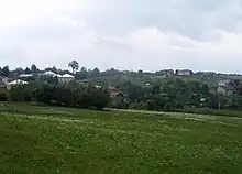
General view
Hostišová is located about 5 kilometres (3 mi) northwest of Zlín. It lies in a hilly lansdcape of the Vizovice Highlands. The highest point is the Strážná hill at 347 m (1,138 ft) above sea level; the village is located on its slopes.
History
The first written mention of Hostišová is from 1397.[2]
Sights
The main landmark is the Chapel of the Visitation of the Virgin Mary from 1869.[3]
An observation tower called Na Strážné is located on the top of the Strážná hill. It is a 14 m (46 ft) high wooden tower on a stone base.[4]
References
- ↑ "Population of Municipalities – 1 January 2023". Czech Statistical Office. 2023-05-23.
- ↑ "Historie obce Hostišová" (in Czech). Obec Hostišová. Retrieved 2023-01-17.
- ↑ "Památky v obci" (in Czech). Obec Hostišová. Retrieved 2023-01-17.
- ↑ "Rozhledna Na Strážné Hostišová". Zlínsko a Luhačovicko (in Czech). Retrieved 2023-01-17.
External links
Wikimedia Commons has media related to Hostišová.
This article is issued from Wikipedia. The text is licensed under Creative Commons - Attribution - Sharealike. Additional terms may apply for the media files.