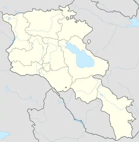
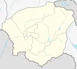
39°53′41″N 45°20′08″E / 39.89472°N 45.33556°E
Horbategh
Հորբատեղ | |
|---|---|
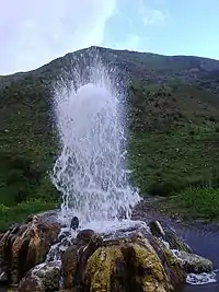
 Natural fountain in Horbategh | |
 Horbategh  Horbategh | |
| Coordinates: 39°53′41″N 45°20′08″E / 39.89472°N 45.33556°E | |
| Country | Armenia |
| Province | Vayots Dzor |
| Municipality | Yeghegis |
| Population | |
| • Total | 242 |
| Time zone | UTC+4 (AMT) |
| Horbategh at GEOnet Names Server | |
Horbategh (Armenian: Հորբատեղ) is a village in the Yeghegis Municipality[2] of the Vayots Dzor Province in Armenia. It is located 20 km north of the Province center, on the southern slopes of the Vardenis mountains, alongside the Artabun River.
Geography
It is located near Yeghegnadzor city of the Vayots Dzor Province, in the northeastern part of the Yeghegnadzor-Selim highway. The village is 23 kilometers away from Yeghegnadzor, the Province center, and 12 kilometers from the main Republican road. Situated at an elevation of 1850 m above sea level, the village is surrounded by towering mountains with peaks. These mountains serve as a source of springs, providing the village with drinking and irrigation water. The village borders the rural communities of Artabuynk, Shatin, Yeghegis, and Salli.
Climate
The climate is cold in winter and cool in summer. Dry and drought years occur frequently.
Population
According to the results of the RA 2011 census, Horbategh had a recorded permanent population of 242 individuals, with a current population of 232 people.[3] Prior to 1918, the village was populated by Azerbaijanis,[4] but afterward, it became predominantly inhabited by Armenians.
The population dynamics of Horbategh over the years:[5]
| Year | 1831 | 1897 | 1926 | 1939 | 1959 | 1970 | 1979 | 1989 | 2001 | 2011 |
|---|---|---|---|---|---|---|---|---|---|---|
| Population | 35 | 406 | 160 | 402 | 252 | 244 | 210 | 223[6] | 280 | 242[3] |
Occupation
The village consists of 92 households, and agriculture serves as the primary economic activity. The residents are primarily involved in arable farming and animal husbandry. The village encompasses 1136.8 hectares of pasturelands, 6.9 hectares of arable lands, and 197 hectares of grasslands.
Historical and cultural sites
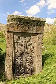
In Horbategh, the Saint Archangels church can be found, constructed in 1692, along with khachkars (cross-stones) dating back to the 13th and 14th centuries.
Public facilities
There is a secondary school, a medical station, and a communication unit in the village.
Gallery
.jpg.webp) Church in Horbategh
Church in Horbategh Khachkar from 1291
 Saint Archangels church in Horbategh
References
- ↑ Statistical Committee of Armenia. "The results of the 2011 Population Census of Armenia" (PDF).
- ↑ "RA Vayots Dzor Marz" (PDF). Marzes of the Republic of Armenia in Figures. 2009. pp. 264–270. Retrieved 27 June 2023.
- 1 2 "Distribution of the current and permanent population of the Republic of Armenia by administrative-territorial divisions and gender" (PDF). 2011. pp. 93–121. Retrieved 27 June 2023.
- ↑ Zaven Korkotyan (1932). The population of Soviet Armenia in the last century (1831–1931) (PDF). Yerevan: Publication of the Melkonian Fund.
- ↑ "Centre of Geodesy and Cartography" SNCO under Cadastre Committee of the Republic of Armenia (2008). Dictionary of settlements of the Republic of Armenia (PDF). Yerevan. p. 184. Archived from the original (PDF) on 9 February 2020.
{{cite book}}: CS1 maint: location missing publisher (link) - ↑ H. Barseghyan, S. Melik-Bakhshyan, E. Aghayan (2001). Dictionary of the toponymy of Armenia and adjacent territories, vol. 5. Yerevan: YSU Publishing House. p. 916.
{{cite book}}: CS1 maint: multiple names: authors list (link)
