| Hengill | |
|---|---|
 Hengill, 2004 | |
| Highest point | |
| Elevation | 803 m (2,635 ft)[1][2] |
| Listing | List of volcanoes in Iceland |
| Coordinates | 64°05′08″N 21°18′48″W / 64.08556°N 21.31333°W |
| Geography | |
 Hengill | |
| Geology | |
| Age of rock | 200,000 years ago[3] |
| Mountain type | Shield volcano, fissure vents |
| Last eruption | 150 CE ± 75 years [2] |
| Climbing | |
| Easiest route | Hike |
Hengill (Icelandic pronunciation: [ˈheiɲcɪtl̥] ⓘ) is a volcanic table mountain situated in the south-west of Iceland, to the south of Þingvellir.
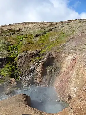
The volcano is still active, as evidenced by its numerous hot springs and fumaroles, but the last eruption occurred approximately 2,000 years ago, before the settlement of Iceland.
Geography
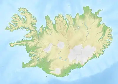
The mountain is south of Lake Thingvallavatn (Þingvallavatn in Icelandic), south-west of the Nesjavellir geothermal area, south of Þingvellir National Park and is the most prominent part of a volcanic region that extends to the coast.[1] South of the mountain towards the coast is the Hellisheiði geothermal area to its south-west, and the town of Hveragerði on Iceland's main ringroad, Route 1 about 45 km (28 mi) east of Reykjavík.[1] At the coast is the port of Þorlákshöfn.[1]


Geology
The mountain is part of the 60 km (37 mi) long Hengill volcanic system,[4][5] which is part of the Reykjanes volcanic belt, and is a hyaloclastite massif of tuyas and tindars.[6] The dominant lava in the Hengill volcanic system is tholeiitic basalt,[7] but andesite and about 20 km2 (7.7 sq mi) rhyolite occur within the central mountain.[6] The largest lava shield covers about 50 km2 (19 sq mi).[8] Four small lava shields are picrite basalt and one lava shield contains about 3 km3 (0.72 cu mi)of olivine tholeiite.[9] It is located at the intersection with two other tectonic volcanic systems, the West volcanic zone of Iceland and South Iceland seismic zone,[10][4] and is co-located to the plate boundary between the North American, Eurasian and Hreppar plates. This intersection is called the Hengill triple junction.[11]
Hveragerdi to the south is an volcano in the volcanic system that became extinct 300,000 years ago, but still has significant seismic activity.[10] It can be regarded as a predecessor volcano.[5] This seismic activity is significant not only because of human impact but also because the earthquakes are grouped along faults striking north–south or east–west, but not north to north-east, as might be supposed based on the surface geological structure and that the rift zone is deep as 3–9 km (1.9–5.6 mi) locally.[10] The earthquake distribution has been interpreted to have defined the heat source of the Hengill volcano.[5]
Extending to the north-east from the central volcano is a fissure swarm with a number of tindars associated with an asymmetrical graben.[6] Lake Thingvallavatn, occupies the proximal graben, and has at its southern end lava flows from the mountain and has hosted explosive eruptions historically. Amongst the faults on the north-west side of the graben is the Almannagjá chasm which extends from the northern shore of Lake Thingvallavatn.[6]
Towards the south-east from the mountain towards the sea is a lava covered plateau whose height is about 300–400 m (980–1,310 ft) with scattered higher tindars and tuyas.[6]
During the Holocene volcanic eruptions in the zone have been predominantly effusive and basaltic with minor tephra production. Erupted lava volumes have ranged from 0.05–3 km3 (0.012–0.720 cu mi).[4]
| Date | Event | Comment |
|---|---|---|
| 2008 CE | Earthquake | No loss of life but 50% property damage in Ölfus region[12] |
| 1789 CE | Subsurface dyke intrusion | Dyke injection later identified[5] |
| 1000 CE | Adjacent volcanic system eruption | Fissure west of Hengill, in the Brennisteinsfjöll volcanic system.[5] This eruption was at the time of a meeting of the Icelandic parliament at Thingvellir.[2] |
| 150±75 CE | Eruption | Along a fissure length of 27 km (17 mi) and about 30 km2 (12 sq mi) lava erupted[4]. Included phreatomagmatic eruption from lake Thingvallavatn.[9][2] |
| 80±75 BCE | Eruption | [2] |
| 1730±50 BCE | Eruption | [2] |
| ~3250 BCE | Eruption | [2] |
| ~3750 BCE | Eruption | Along a fissure length of 20 km (12 mi) and about 30 km2 (12 sq mi) lava erupted[4][2] |
| ~5000 BCE | Eruption | [2] |
| ~5550±500 BCE | Eruption | Not well dated[9][2] |
| ~7100 BCE | Eruption | [2] |
| ~7300 BCE | Eruption | [2] |
| ~7550 BCE | Eruption | [2] |
| ~8200 BCE | Eruption | [9][2] |
| ~8250 BCE | Eruption | [2] |
| ~8350 BCE | Eruption | [2] |
Risk
The official view of the volcanic hazard is that it is confined to a radius of 30 km (19 mi) and is related to lava flows, plugging of geothermal boreholes by lava, volcano-tectonic faulting and volcanic gas pollution.[13] [lower-alpha 1]
Geothermal resources
There are three associated geothermal areas related to the high amount of fissuring in the Hengill volcanic system producing high water subsurface permeability,[14] resulting in Iceland’s second largest geothermal field so being an important source of energy for the south of the country:[4]
- Nesjavellir geothermal system, which is captured at the Nesjavellir power station near the western shore of the lake Þingvallavatn
- Hellisheiði, which has the largest power station in Iceland, Hellisheiði power station, approximately 11 km (6.8 mi) south-west of Nesjavelli. Both stations are operated by Orkuveita Reykjavíkur (Reykjavik Energy).
- Hveragerdi, whose hydrothermal waters have been used for greenhouse heating.
The area with its mountains and hot springs is well suited for hiking and there are a lot of hiking trails. The town of Hveragerði with its multitude of hot springs is also part of the Hengill area.
Culture
Some folk tales are connected to the region.[15] For example, in a folk tale collected and published by Jón Árnason in 1862, a young farmer is said to have killed the sleeping troll woman Jóra [ˈjouːra] while she lay in wait for innocent wanderers or horsemen on the trail over Dyrafjöll [ˈtɪːraˌfjœtl̥] north of Hengill.[16] In another folk tale, according to some people, a woman's body found in the area was believed to be that of Halla, the wife of the famous Icelandic outlaw Fjalla-Eyvindur.[16]
See also
Notes
- ↑ It is unclear why the known previous risks of either a phreatomagmatic eruption and/or of a rhyolitic eruption are not mentioned in this official hazard analysis. There is recent work suggesting the magma chamber may extend further in depth than past work suggested and this may or may not have been taken into account.
References
- 1 2 3 4 "National Land Survey of Iceland : Sýrfell". Landmælingar Íslands. 30 December 2023.
- 1 2 3 4 5 6 7 8 9 10 11 12 13 14 15 16 Venzke 2023 "Hengill". Global Volcanism Program. Smithsonian Institution.
- ↑ Sæmundsson 2019, 4. Eruption history and pattern.
- 1 2 3 4 5 6 Sæmundsson 2019, Short Description.
- 1 2 3 4 5 Hernández et al. 2012, p. 2437.
- 1 2 3 4 5 Sæmundsson 2019, 2. Morphology and topography.
- ↑ Sæmundsson 2019, 1. Geological setting and tectonic context.
- ↑ Sæmundsson 2019, 7. Erupted material & Grain size distribution:Basaltic lava flows.
- 1 2 3 4 Sæmundsson 2019, 4. Eruption history and pattern:Fissure swarm.
- 1 2 3 Zakharova & Spichak 2012, p. 5.
- ↑ Decriem et al. 2010, p. 1128.
- ↑ Bessason et al. 2012, 5. Summary and Conclusions.
- ↑ Sæmundsson 2019, 8. Volcanic hazards.
- ↑ Zakharova & Spichak 2012, pp. 5–6.
- ↑ "Ísmús - íslenskur músík- og menningararfur". www.ismus.is. Retrieved 2023-12-31.
- 1 2 Árnason, Jón (1862–1864). Íslenzkar Þjóðsögur og Æfintýri. Leipzig: J.C. Hinrichs. pp. II: 251.
Sources
- Venzke, Edward, ed. (15 December 2023). "Global Volcanism Program, 2023. Hengill (371050) in [Database] Volcanoes of the World (v. 5.1.5; 15 Dec 2023)". Smithsonian Institution. doi:10.5479/si.GVP.VOTW5-2023.5.1.
- Zakharova, O.K.; Spichak, V.V. (2012). "Geothermal fields of Hengill volcano, Iceland". Journal of Volcanology and Seismology. 6 (1): 1–14. Bibcode:2012JVolS...6....1Z. doi:10.1134/S074204631201006X. S2CID 129031347. Retrieved 30 December 2023.
- Sæmundsson, Kristján (2019). "Catalogue of Icelandic Volcanoes - Hengill". Icelandic Meteorological Office, Institute of Earth Sciences at the University of Iceland, Civil Protection Department of the National Commissioner of the Iceland Police. Retrieved 30 December 2023.
- Decriem, J.; Árnadóttir, T.; Hooper, A.; Geirsson, H.; Sigmundsson, F.; Keiding, M.; Ófeigsson, B. G.; Hreinsdóttir, S.; Einarsson, P.; LaFemina, P.; Bennett, R. A. (2010). "The 2008 May 29 earthquake doublet in SW Iceland". Geophysical Journal International. 181 (2): 1128–1146. Bibcode:2010GeoJI.181.1128D. doi:10.1111/j.1365-246x.2010.04565.x.
- Bessason, B.; Sólnes, J.; Bjarnason, J.Ö.; Guðmundsson, A.; Steedman, S. (2012). "Comprehensive damage analysis of buildings affected by the 2008 South Iceland earthquake" (PDF). Proceedings of the 15th World Conference of Earthquake Engineering. Sociedade Portuguesa de Engenharia Sismica (SPES). ISBN 9781634396516. Retrieved 30 December 2023.
- Hernández, P.A.; Pérez, N.M.; Fridriksson, T.; Egbert, J.; Ilyinskaya, E.; Thárhallsson, A.; Ívarsson, G.; Gíslason, G.; Gunnarsson, I.; Jónsson, B.; Padrón, E. (2012). "Diffuse volcanic degassing and thermal energy release from Hengill volcanic system, Iceland" (PDF). Bulletin of Volcanology. 74 (10): 2435–2448. Bibcode:2012BVol...74.2435H. doi:10.1007/s00445-012-0673-2. S2CID 128693606. Retrieved 30 December 2023.
External links
- Hengill in the Catalogue of Icelandic Volcanoes
- Map