Hebron Governorate | |
|---|---|
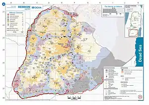
 2018 United Nations map of the area, showing the Israeli occupation arrangements in the governorate | |
 | |
| Coordinates: 31°30′N 35°06′E / 31.5°N 35.1°E | |
| Country | |
| Area | |
| • Total | 1,060 km2 (410 sq mi) |
| Population (2017 Census)[1] | |
| • Total | 711,223 |
| This figure excludes the Israeli West Bank Settlements | |
| Governorates of the West Bank (State of Palestine) |
|---|
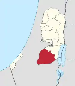
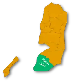
The Hebron Governorate (Arabic: محافظة الخليل, romanized: Muḥāfaẓat al-Ḫalīl) is an administrative district of Palestine in the southern West Bank.
The governorate's land area is 1,060 square kilometres (410 sq mi) and its population according to the Palestinian Central Bureau of Statistics in mid-year 2019 was 1,004,510. This makes the Hebron Governorate the largest of 16 governorates in both population and land area in the Palestinian territories.[2] The city of Hebron is the district capital or muhfaza (seat) of the governorate. The governor is Hussein al-Araj and its district commander is Abdel Fattah al-Ju’eidi.[3]
During the first six months of the First Intifada 42 people in Hebron Governorate were killed by the Israeli army.[4]
Localities
The Hebron Governorate has a total of seven cities and eighteen towns. The governorate also contains more than 100 Bedouin villages and settlements that are not listed below.[2]
Cities
- Dura
- Halhul
- Hebron (capital)
- Yatta
- ad-Dhahiriya
Municipalities
The following localities have municipality status from the Ministry of Local Government of the Palestinian National Authority.
Village councils
The following have populations over 1,000 persons.
|
|
Refugee camps
See also
References
- ↑ "Main Indicators by Type of Locality - Population, Housing and Establishments Census 2017" (PDF). Palestinian Central Bureau of Statistics (PCBS). Retrieved 2021-01-19.
- 1 2 Hebron Governorate Statistical Yearbook No. 2, page 59,60. PCBS, November 2010
- ↑ Hébron
- ↑ B'Tselem information sheet July 1989. p.4. pdf

