Húnabyggð | |
|---|---|
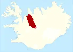
 Location of Húnabyggð | |
| Coordinates: 65°40′N 20°18′W / 65.667°N 20.300°W | |
| Country | Iceland |
| Region | Northwestern Region |
| Constituency | Northwest Constituency |
| Established | 1876 |
| Area | |
| • Total | 4,000 km2 (2,000 sq mi) |
| Population (2021) | |
| • Total | 1,322 |
| • Density | 0.33/km2 (0.9/sq mi) |
| Postal code(s) | 540, 541 |
| Municipal number | 5613 |
Húnabyggð (Icelandic pronunciation: [ˈhuːnaˌpɪɣθ]) is a municipality in the north of Iceland, which was formed with the merger of Blönduós and Húnavatnshreppur.[1] A vote was held in February 2022 where 97.8% of Blönduós inhabitants and 62.3% of Húnavatnshreppur inhabitants voted in favour of the merge.[2] The merger was finalized in the municipality elections in March 2022.
Húnabyggð is among the largest municipalities of Iceland in terms of area and reaches from Húnaflói, where Blönduós is situated, to the interior, where Langjökull and Hofsjökull are situated. Blönduvirkjun hydropower plant is situated in the municipality.
References
- ↑ Árni Sæberg. "Samþykktu að sameinað sveitarfélag fái nafnið Húnabyggð - Vísir". visir.is (in Icelandic).
- ↑ "Húnvetningar samþykktu sameiningu". RÚV (in Icelandic). 19 February 2022.
This article is issued from Wikipedia. The text is licensed under Creative Commons - Attribution - Sharealike. Additional terms may apply for the media files.