Höpen Airfield Segelflugplatz Höpen (Advanced Landing Ground B-154) | |||||||||||
|---|---|---|---|---|---|---|---|---|---|---|---|
 Runway, gliders and hangar on a foggy day | |||||||||||
| Summary | |||||||||||
| Airport type | Glider | ||||||||||
| Owner | LSV Schneverdingen | ||||||||||
| Location | Schneverdingen, Germany | ||||||||||
| Elevation AMSL | 73 m / 268 ft | ||||||||||
| Coordinates | 53°08′50″N 009°47′41″E / 53.14722°N 9.79472°E | ||||||||||
| Website | www.lsv-schneverdingen.de | ||||||||||
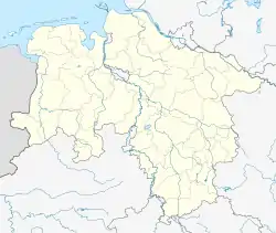
| Map | |||||||||||
 B-154 Location of Höpen Airfield | |||||||||||
| Runways | |||||||||||
| |||||||||||
Höpen Airfield is a glider airfield near the town of Schneverdingen in Lower Saxony, Germany. It supports glider flying with no commercial aviation at the field.
History
Towards the end of World War II, the landing field was used by the British Royal Air Force as Advanced Landing Ground B-154 Reinsehlen.
References
- World Airport Codes Flugplatz Hoepen
- Johnson, David C. (1988), U.S. Army Air Forces Continental Airfields (ETO), D-Day to V-E Day; Research Division, USAF Historical Research Center, Maxwell AFB, Alabama.
This article is issued from Wikipedia. The text is licensed under Creative Commons - Attribution - Sharealike. Additional terms may apply for the media files.