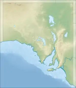
| Gum Creek South Australia | |||||||||||||||
|---|---|---|---|---|---|---|---|---|---|---|---|---|---|---|---|
 Gum Creek | |||||||||||||||
| Coordinates | 33°42′46.3″S 138°45′55.8″E / 33.712861°S 138.765500°E | ||||||||||||||
| Population | 16 (2016 census)[1] | ||||||||||||||
| Postcode(s) | 5417[2] | ||||||||||||||
| LGA(s) | Regional Council of Goyder | ||||||||||||||
| State electorate(s) | Stuart[2] | ||||||||||||||
| Federal division(s) | Grey[2] | ||||||||||||||
| |||||||||||||||
| Footnotes | Coordinates[3] | ||||||||||||||
Gum Creek is a rural locality in the Mid North region of South Australia, situated in the Regional Council of Goyder.[2] It was established in August 2000, when boundaries were formalised for the "long established local name".[3] It is named for the Gum Creek pastoral property, which originally extended from Farrell Flat to Mount Bryan, with the homestead being located in the Gum Creek locality.[4][3] The property was owned by a number of notable figures, with Sir John Duncan succeeding Sir Walter Hughes as owner.[5]
A Primitive Methodist church opened at "Iron Mine, Gum Creek" in October 1871, built by J. & T. Pearce of Kooringa for a cost of £140.[6] A Sunday school at Ironmine Methodist Church, as it came to be known, was built in 1923.[7] The church held a 75th anniversary celebration in April 1946.[8] The church closed in 1974 and was converted to a residence.[9]
Gum Creek School opened in 1898 and closed in 1957.[10] Prior to this, a day school was reported as being run by a Mr. Rogers in the Gum Creek Chapel during the 1870s.[11] The later school building survives today, though is in a derelict state.
A telephone office opened at Gum Creek on 1 May 1926, became a postal receiving office on 3 May 1926 and was upgraded to a post office on 1 July 1927. It closed on 13 March 1953.[12]
It formerly had its own tennis, football and cricket teams.[13][14]
References
- ↑ Australian Bureau of Statistics (27 June 2017). "Gum Creek (State Suburb)". 2016 Census QuickStats. Retrieved 14 June 2021.
- 1 2 3 4 "Search result(s) for Gum Creek, 5417". Location SA Map Viewer. Government of South Australia. Retrieved 14 December 2016.
- 1 2 3 "Search result(s) for Peep Hill, 5374". Property Location Browser. Government of South Australia. Retrieved 26 November 2016.
- ↑ "GUM CREEK CHEEP STATION". The Register (Adelaide). Vol. LXXXV, no. 22, 936. South Australia. 13 May 1920. p. 5. Retrieved 27 December 2016 – via National Library of Australia.
- ↑ "BURRA PASTORAL ESTATES". The Kapunda Herald. Vol. XLII, no. 3, 327. South Australia. 26 January 1906. p. 6. Retrieved 27 December 2016 – via National Library of Australia.
- ↑ "THE MUTILATED LAND BILL". South Australian Register. Vol. XXXVI, no. 7767. South Australia. 6 October 1871. p. 7. Retrieved 27 December 2016 – via National Library of Australia.
- ↑ "NEWS FROM THE COUNTRY". The Register (Adelaide). Vol. LXXXVIII, no. 25, 602. South Australia. 17 January 1923. p. 11. Retrieved 27 December 2016 – via National Library of Australia.
- ↑ "Church Anniversary at Ironmine". Burra Record. Vol. 69, no. 13. South Australia. 2 April 1946. p. 4. Retrieved 27 December 2016 – via National Library of Australia.
- ↑ "Lower North Regional Heritage Survey – District Council of Burra Burra" (PDF). Department of Environment, Water and Natural Resources. Retrieved 8 February 2017.
- ↑ "Place Names of South Australia – G". The Manning Index of South Australian History. State Library of South Australia. Retrieved 27 December 2016.
- ↑ "NOTES BY THE WAY". South Australian Chronicle And Weekly Mail. Vol. XVII, no. 831. South Australia. 18 July 1874. p. 10. Retrieved 27 December 2016 – via National Library of Australia.
- ↑ "Gum Creek (2)". Post Office Reference. Premier Postal. Retrieved 27 December 2016.
- ↑ "GUM CREEK". Burra Record. Vol. XV, no. 988. South Australia. 24 April 1912. p. 3. Retrieved 27 December 2016 – via National Library of Australia.
- ↑ "FOOTBALL". Burra Record. Vol. XV, no. 636. South Australia. 27 July 1904. p. 3. Retrieved 27 December 2016 – via National Library of Australia.