Grzybowa Góra | |
|---|---|
Village | |
.jpg.webp) Voluntary Fire Brigade in Grzybowa Góra | |
 Grzybowa Góra  Grzybowa Góra | |
| Coordinates: 51°7′52″N 20°58′19″E / 51.13111°N 20.97194°E | |
| Country | |
| Voivodeship | Świętokrzyskie |
| County | Skarżysko |
| Gmina | Skarżysko Kościelne |
| Population | 1,052 |
| Time zone | UTC+1 (CET) |
| • Summer (DST) | UTC+2 (CEST) |
| Vehicle registration | TSK |
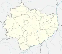
Grzybowa Góra [ɡʐɨˈbɔva ˈɡura] is a village in the administrative district of Gmina Skarżysko Kościelne, within Skarżysko County, Świętokrzyskie Voivodeship, in south-central Poland. It lies approximately 5 kilometres (3 mi) east of Skarżysko Kościelne, 5 km (3 mi) north-east of Skarżysko-Kamienna, and 38 km (24 mi) northeast of the regional capital Kielce.[1] The name literally translates as: "Mushroom Mountain".
History
Grzybowa Góra was the location of a Paleolithic industrial settlement, which is now an archaeological site, part of the Rydno Archaeological Reserve, consisting of several hundred former Paleolithic sites stretching from Skarżysko-Kamienna to Wąchock.[2] The site was discovered in the 1920s.[2]
Grzybowa Góra was a private church village of the Wąchock Abbey,[3] administratively located in the Radom County in the Sandomierz Voivodeship in the Lesser Poland Province of the Polish Crown.[4]
In the Third Partition of Poland, in 1795, the village was annexed by Austria. Following the Austro-Polish War of 1809, the village was regained by Poles and included within the short-lived Duchy of Warsaw. After the duchy's dissolution, in 1815, the village fell to the Russian Partition of Poland. In 1827, it had a population of 204, which grew to 293 until the late 19th century.[3] On April 19, 1863, Grzybowa Góra was the site of a battle of the Polish January Uprising.[5] A Polish insurgent unit led by Ludwik Michalski defeated a three times larger Russian unit, and the surviving Russian soldiers retreated in panic to Radom.[5] Following World War I, in 1918, Poland regained independence and control of the village.
References
- ↑ "Central Statistical Office (GUS) - TERYT (National Register of Territorial Land Apportionment Journal)" (in Polish). 2008-06-01.
- 1 2 Nina Glińska. "Rezerwat archeologiczny Rydno - zespół paleolitycznych osad przemysłowych wraz z kopalnią hematytu". Zabytek.pl (in Polish). Retrieved 7 August 2021.
- 1 2 Słownik geograficzny Królestwa Polskiego i innych krajów słowiańskich, Tom II (in Polish). Warsaw. 1881. p. 894.
{{cite book}}: CS1 maint: location missing publisher (link) - ↑ Województwo sandomierskie w drugiej połowie XVI wieku; Cz.1, Mapy, plany (in Polish). Warsaw: Wydawnictwo Naukowe PWN. 1993. p. 3.
- 1 2 Zieliński, Stanisław (1913). Bitwy i potyczki 1863-1864. Na podstawie materyałów drukowanych i rękopiśmiennych Muzeum Narodowego w Rapperswilu (in Polish). Rapperswil: Muzeum Narodowe w Rapperswilu. p. 130.
