Gornji Bučumet
Горњи Бучумет Upper Bučumet | |
|---|---|
Settlement | |
 Gornji Bučumet | |
| Coordinates: 42°55′N 21°37′E / 42.917°N 21.617°E | |
| Country | |
| District | Jablanica District |
| Municipality | Medveđa |
| Population (2002) | |
| • Total | 139 |
| Time zone | UTC+1 (CET) |
| • Summer (DST) | UTC+2 (CEST) |
| Area code | +381 16 |
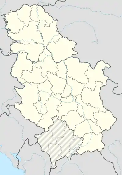
Gornji Bučumet (Serbian Cyrillic: Горњи Бучумет, Upper Bučumet) is a settlement in the municipality of Medveđa, in southern Serbia. According to the 2002 census, the village had a population of 139 people.
Name
The name bučumet is derived from Turkish bućumiš, which means thick, impassable forest.
According to B. Simeonov, the toponym is of Thraco-Roman origin.[1]
Geography
The village of Bučumet is composed out of three mahala (neighbourhoods): Upper, Lower (Доњи) and Middle (Средњи) Bučumet, which are all settlements registered separately in the census.[2] The three settlements lie in the South Morava basin, above the Jablanica river, and as such are located in the Upper Jablanica region. The highest mountain in Upper Bučumet is Paramid (853), with the mountain of Sv. Petar (1149) being located in Middle Bučumet. The three neighbourhoods of Bučumet are 470 to 853 metres above sea level.
History
There is a medieval church built on the ruins of an older church.[2]
During the Toplica-Jablanica Operation (Топличко-јабланичка операција 1944, German: Kehraus) in 1944, the Serbian Volunteer Corps and a German regimental group Dizner (Дизнер) were mobilized in the Statovac (Upper and Lower) - Bučumet (Upper and Lower) line, together with other Axis forces, surrounded the Yugoslav Partisans which were situated in the Vidojevica mountain and Rgač mountain. This was the third phase of the Operation, codenamed Halali. The Partisans managed to extract the surrounded forces.[3]
Infrastructure
The rural settlement of Gornji Bučumet is of the "broken type" (Села разбијеног типа), with scattered residential structure. The village has 42,9% inhabitants dependent on agriculture (livestock-crop and viticulture).[4]
There is a nearby gold mine, in Lece, located some kilometres west, where many inhabitants have worked in the past.
Demographics
According to the 2002 census, the village had a population of 139 people, all of whom were ethnic Serbs. There were 119 adults, and the average life span was 47,3 years (44,7 in males, and 50,3 in females). There were 52 households, with average number of family members at 2,67.
| Ethnic group | 1948 | 1953 | 1961 | 1971 | 1981 | 1991 | 2002[5] |
|---|---|---|---|---|---|---|---|
| Serbs | 139 (100%) | ||||||
| Total[6] | 436 | 451 | 430 | 342 | 267 | 203 | 139 |
See also
- Bučum, village in the municipality of Svrljig, Serbia
References
- ↑ Българска академия на науките 1996, p. 93: "B. Simeonov découvre une couche de toponymes d'origine thraco-romane (Bucumet, Pinet, Kovcel, Muskel, Cikura) et donne leurs étymologies. Boris Simeonov a écrit plus de 95 études onomatologiques plus courtes qui embrassent la toponymie ..."
- 1 2 Туристичка организација општине Медвеђа Archived 2014-04-13 at the Wayback Machine: "У селу Бучумету је на темељима старе црквице сазидана нова слично као у низу села на подручју Лесковачког краја, нпр. У селима Прекопчелица, Штулцу, Рафуну, Лозану и др. Тешко је казати из којег је времена јер археолошких налаза нема. Ипак претпостављамо да је средњовековна. Најранији запис за сада је онај у турском попису из половине XV века. Током XVI века Бучумет сеспомиње у још три турска пописа. Данас постоје три махале истог села: Горњи, Доњи и Средњи Бучумет."
- ↑ Поповић 1988
- ↑ Stamenković 2002, p. 18: "ГОРЊИ БУЧУМЕТ (203 ст.), сточарско-ратарско и воћарско (42,9% аграрног ст.) сеоско насеље разбије- ног типа"
- ↑ Popis stanovništva, domaćinstava i Stanova 2002. Knjiga 1: Nacionalna ili etnička pripadnost po naseljima. Republika Srbija, Republički zavod za statistiku Beograd 2003. ISBN 86-84433-00-9
- ↑ Serbia censuses 1948–1991
Sources
- Srboljub Đ Stamenković (Србољуб Ђ Стаменковић) (2002). Географска енциклопедија насеља Србије: М-Р, Volume 3 (in Serbian). Belgrade: Географски факултет. p. 18.
ГОРЊИ БУЧУМЕТ
Българска академия на науките (1996). Balkansko ezikoznanie: Linguistique balkanique, Volumes 38-39 (in French). Sofia: Българската академия на науките. Коча Поповић (1988). БЕЛЕШКЕ УЗ РАТОВАЊЕ (in Serbian). Београд: БИГЗ.
Further reading
- Dragoljub Ž Mirčetić, Milija Radovanović (1981). Partizanska opština Bučumet: (hronika narodnooslobodilačke borbe u selima Bučumet, Gazdare, Lalinovac, Negosavlje, Rujkovac i Crni Vrh) (in Serbian). Opštinski odbor SUBNOR.
