Good Hope, Holmes County, Mississippi | |
|---|---|
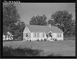
 Plantation manager's home at Good Hope in October 1939 | |
 Good Hope  Good Hope | |
| Coordinates: 33°06′06″N 90°18′01″W / 33.10167°N 90.30028°W | |
| Country | United States |
| State | Mississippi |
| County | Holmes |
| Elevation | 112 ft (34 m) |
| Time zone | UTC-6 (Central (CST)) |
| • Summer (DST) | UTC-5 (CDT) |
| Area code | 662 |
| GNIS feature ID | 670463[1] |
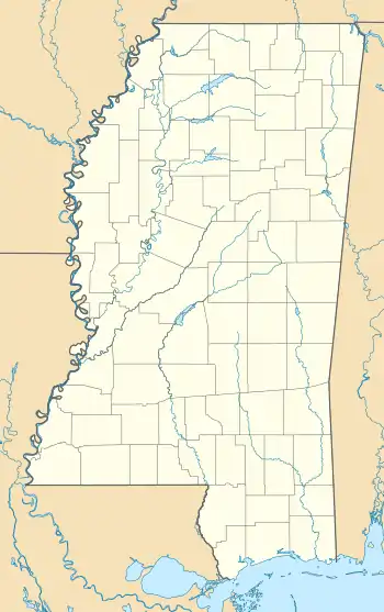
Good Hope is an unincorporated community in Holmes County, Mississippi, United States. Good Hope is located on U.S. Route 49E, 7.2 miles (11.6 km) southwest of Tchula.[2]
History
Good Hope is named for the Good Hope plantation. Colonel William R. Miles, who commanded Miles' Legion at the Siege of Port Hudson and the Battle of Plains Store, lived on the Good Hope plantation.[3][4]
Good Hope is located on the Canadian National Railway.[5]
A post office operated under the name Good Hope from 1910 to 1916.[6]
Marion Post Wolcott documented people and scenes from the Good Hope plantation in October 1939 as part of her work with the Farm Security Administration.[7]
References
- ↑ "Good Hope". Geographic Names Information System. United States Geological Survey, United States Department of the Interior.
- ↑ Holmes County, Mississippi General Highway Map (PDF) (Map). Mississippi Department of Transportation. 2006. Retrieved April 6, 2012.
- ↑ Report of cases decided by the Supreme Court of Mississippi. Nashville, Tennessee: Marshall and Bruce. 1905. p. 625.
- ↑ "Battle Unit Details - Miles' Legion, Louisiana Volunteers". National Park Service. Retrieved June 4, 2021.
- ↑ Howe, Tony. "Good Hope, Mississippi". Mississippi Rails. Retrieved June 3, 2021.
- ↑ "Holmes County". Jim Forte Postal History. Retrieved June 3, 2021.
- ↑ "Good Hope Plantation". Library of Congress. Retrieved June 4, 2021.
This article is issued from Wikipedia. The text is licensed under Creative Commons - Attribution - Sharealike. Additional terms may apply for the media files.
