Gojōme
五城目町 | |
|---|---|
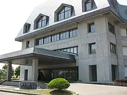
 Gojōme Town Hall | |
 Flag  Seal | |
Location of Gojōme in Akita Prefecture | |
 | |
 Gojōme | |
| Coordinates: 39°56′38″N 140°6′41.9″E / 39.94389°N 140.111639°E | |
| Country | Japan |
| Region | Tōhoku |
| Prefecture | Akita |
| District | Minamiakita |
| Area | |
| • Total | 214.92 km2 (82.98 sq mi) |
| Population (February 28, 2023) | |
| • Total | 8,317 |
| • Density | 39/km2 (100/sq mi) |
| Time zone | UTC+9 (Japan Standard Time) |
| Phone number | 018-852-5100 |
| Address | 1-1-1 Nishi-isonome, Gojōme-machi, Minami-akita-gun, Akita-ken 018-1725 |
| Climate | Cfa/Dfa |
| Website | Official website |
| Symbols | |
| Bird | Japanese bush-warbler |
| Flower | Lilium auratum |
| Tree | Cryptomeria |

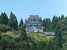
.JPG.webp)

Gojōme (五城目町, Gojōme-machi) is a town located in Akita, Japan. As of 28 February 2023, the town had an estimated population of 8317 in 3870 households[1] and a population density of 39 persons per km2. The total area was 214.92 square kilometres (82.98 sq mi).
Geography
Gojōme is located in coastal plains of northwestern Akita Prefecture, with mountainous areas in the east and urban areas and rural areas in the west. It is approximately 30 km north of the city of Akita.
Neighboring municipalities
Akita Prefecture
Climate
Gojōme has a Humid continental climate (Köppen climate classification Dfa) with large seasonal temperature differences, with warm to hot (and often humid) summers and cold (sometimes severely cold) winters. Precipitation is significant throughout the year, but is heaviest from August to October. The average annual temperature in Gojōme is 11.2 °C (52.2 °F). The average annual rainfall is 1,665.0 mm (65.55 in) with September as the wettest month. The temperatures are highest on average in August, at around 24.1 °C (75.4 °F), and lowest in January, at around −0.5 °C (31.1 °F).[2]
| Climate data for Gojōme (1991−2020 normals, extremes 1976−present) | |||||||||||||
|---|---|---|---|---|---|---|---|---|---|---|---|---|---|
| Month | Jan | Feb | Mar | Apr | May | Jun | Jul | Aug | Sep | Oct | Nov | Dec | Year |
| Record high °C (°F) | 12.9 (55.2) |
19.3 (66.7) |
20.0 (68.0) |
28.3 (82.9) |
31.7 (89.1) |
33.3 (91.9) |
36.6 (97.9) |
38.1 (100.6) |
38.1 (100.6) |
30.1 (86.2) |
24.6 (76.3) |
18.6 (65.5) |
38.1 (100.6) |
| Mean daily maximum °C (°F) | 2.6 (36.7) |
3.5 (38.3) |
7.7 (45.9) |
14.2 (57.6) |
19.8 (67.6) |
24.1 (75.4) |
27.3 (81.1) |
29.1 (84.4) |
25.4 (77.7) |
19.0 (66.2) |
12.1 (53.8) |
5.5 (41.9) |
15.9 (60.6) |
| Daily mean °C (°F) | −0.5 (31.1) |
−0.1 (31.8) |
3.1 (37.6) |
8.7 (47.7) |
14.5 (58.1) |
19.0 (66.2) |
22.8 (73.0) |
24.1 (75.4) |
19.9 (67.8) |
13.3 (55.9) |
7.2 (45.0) |
1.8 (35.2) |
11.2 (52.1) |
| Mean daily minimum °C (°F) | −3.5 (25.7) |
−3.6 (25.5) |
−1.2 (29.8) |
3.2 (37.8) |
9.4 (48.9) |
14.5 (58.1) |
19.2 (66.6) |
20.0 (68.0) |
15.4 (59.7) |
8.6 (47.5) |
3.0 (37.4) |
−1.3 (29.7) |
7.0 (44.6) |
| Record low °C (°F) | −14.4 (6.1) |
−14.2 (6.4) |
−12.1 (10.2) |
−5.8 (21.6) |
−0.7 (30.7) |
5.5 (41.9) |
11.1 (52.0) |
11.3 (52.3) |
5.4 (41.7) |
0.5 (32.9) |
−6.1 (21.0) |
−10.5 (13.1) |
−14.4 (6.1) |
| Average precipitation mm (inches) | 131.5 (5.18) |
101.2 (3.98) |
92.7 (3.65) |
94.0 (3.70) |
109.4 (4.31) |
107.4 (4.23) |
191.8 (7.55) |
174.4 (6.87) |
163.5 (6.44) |
164.0 (6.46) |
176.1 (6.93) |
159.1 (6.26) |
1,665 (65.55) |
| Average snowfall cm (inches) | 156 (61) |
126 (50) |
44 (17) |
1 (0.4) |
0 (0) |
0 (0) |
0 (0) |
0 (0) |
0 (0) |
0 (0) |
7 (2.8) |
79 (31) |
410 (161) |
| Average precipitation days (≥ 1.0 mm) | 21.8 | 18.6 | 15.6 | 12.0 | 11.5 | 10.8 | 12.6 | 10.7 | 12.5 | 14.7 | 18.7 | 22.3 | 181.8 |
| Average snowy days (≥ 3 cm) | 18.2 | 15.9 | 6.0 | 0.2 | 0 | 0 | 0 | 0 | 0 | 0 | 0.6 | 9.1 | 50 |
| Mean monthly sunshine hours | 36.8 | 59.3 | 105.0 | 155.0 | 176.4 | 173.6 | 146.8 | 174.5 | 145.4 | 127.7 | 80.4 | 43.7 | 1,424.6 |
| Source: Japan Meteorological Agency[3][2] | |||||||||||||
Demographics
Per Japanese census data,[4] the population of Gojōme peaked at around the year 1960 and has been in steady decline since then.
| Year | Pop. | ±% p.a. |
|---|---|---|
| 1920 | 15,026 | — |
| 1930 | 15,813 | +0.51% |
| 1940 | 16,177 | +0.23% |
| 1950 | 19,536 | +1.90% |
| 1960 | 20,025 | +0.25% |
| 1970 | 17,413 | −1.39% |
| 1980 | 15,953 | −0.87% |
| 1990 | 14,161 | −1.18% |
| 2000 | 12,372 | −1.34% |
| 2010 | 10,517 | −1.61% |
| 2020 | 8,538 | −2.06% |
History
The area of present-day Gojōme was part of ancient Dewa Province, dominated by the Satake clan during the Edo period, who ruled Kubota Domain under the Tokugawa shogunate. The village of Gojōme was created on April 1, 1889 within Minamiakita District, Akita with the establishment of the modern municipalities system. It was elevated to town status on January 18, 1896.
Government
Gojōme has a mayor-council form of government with a directly elected mayor and a unicameral town council of 14 members. Gojōme, together with the city of Noshiro and the other municipalities of Yamamoto District contributes four members to the Akita Prefectural Assembly. In terms of national politics, the town is part of Akita 2nd district of the lower house of the Diet of Japan.
Economy
The economy of Gojōme is based primarily on agriculture. The town is known for the Morning Market on weekends, which claims a history of over 500 years.
Education
Gojōme has one public elementary school and one public middle school operated by the town government. The town has one public high school operated by the Akita Prefectural Board of Education.
Transportation
Railway
The Ōu Main Line passes through the Okawa neighborhood of the town, but there is no station. In the past, the Akita Chuo Kotsu Line linked Gojōme to Hachirōgata Station in Hachirōgata, but the line was abolished in 1969.
Highway
Noted people from Gojōme
- Masashi Kudo, professional boxer
- Yasaburo Sugawara, wrestler
- Wakakoma Kenzo, sumo wrestler
References
- ↑ "Gojōme town official statistics" (in Japanese). Japan.
- 1 2 気象庁 / 平年値(年・月ごとの値). JMA. Retrieved April 5, 2022.
- ↑ 観測史上1~10位の値(年間を通じての値). JMA. Retrieved April 5, 2022.
- ↑ Gojōme population statistics
External links
 Media related to Gojōme, Akita at Wikimedia Commons
- Official Website (in Japanese)