Gibloux | |
|---|---|
 Coat of arms | |
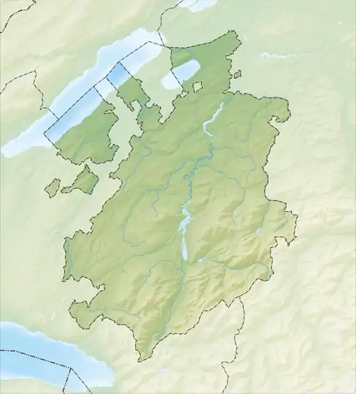
Location of Gibloux | |
 Gibloux  Gibloux | |
| Coordinates: 46°44′N 7°6′E / 46.733°N 7.100°E | |
| Country | Switzerland |
| Canton | Fribourg |
| District | Sarine |
| Government | |
| • Mayor | Syndic |
| Area | |
| • Total | 36.06 km2 (13.92 sq mi) |
| Elevation | 687 m (2,254 ft) |
| Population (31 December 2018)[2] | |
| • Total | 7,447 |
| • Density | 210/km2 (530/sq mi) |
| Time zone | UTC+01:00 (Central European Time) |
| • Summer (DST) | UTC+02:00 (Central European Summer Time) |
| Postal code(s) | 1695-6, 1726-8 |
| SFOS number | 2236 |
| Surrounded by | Autigny, Arconciel, Cottens, Hauterive, Le Glèbe, Pont-en-Ogoz |
| Website | https://www.commune-gibloux.ch SFSO statistics |
Gibloux (French: [ʒiblu]; Arpitan: Dzubyà [dzyˈbjɑ]) is a municipality in the district of Sarine in the canton of Fribourg in Switzerland. The municipality was formed 1 January 2016, from the merger of Corpataux-Magnedens, Farvagny, Le Glèbe, Rossens and Vuisternens-en-Ogoz.[3]
History
The village of Rossens is first mentioned in 1162 as Rossens. It was formerly known by its German name Rossing, however, that name is no longer used.[4]
Geography
Gibloux has an area, (as of the 2004/09 survey) of 36.06 km2 (13.92 sq mi).[5] Of this area, about 63.8% is used for agricultural purposes, while 23.9% is forested. Of the rest of the land, 11.6% is settled (buildings or roads) and 0.7% is unproductive land. In the 2013/18 survey a total of 276 ha (680 acres) or about 7.6% of the total area was covered with buildings. Of the agricultural land, 14 ha (35 acres) is used for orchards and vineyards, 2,215 ha (5,470 acres) is fields and grasslands and 53 ha (130 acres) consists of alpine grazing areas. Since 1981 the amount of agricultural land has decreased by 181 ha (450 acres). Over the same time period the amount of forested land has increased by 16 ha (40 acres). Rivers and lakes cover 37 ha (91 acres) in the municipality.[6][7]
Demographics
Gibloux has a population (as of 31 December 2020) of 7,622.[8] As of 2014, 15.2% of the population are resident foreign nationals. Over the last 4 years (2010-2014) the population has changed at a rate of 13.39%. The birth rate in the municipality, in 2014, was 8.7, while the death rate was 5.0 per thousand residents.[7]
As of 2014, children and teenagers (0–19 years old) make up 25.2% of the population, while adults (20–64 years old) are 62.7% of the population and seniors (over 64 years old) make up 12.1%.[7]
In 2014 there were 2,812 private households in Gibloux with an average household size of 2.58 persons. In 2013 the rate of construction of new housing units per 1000 residents was 7.42. The vacancy rate for the municipality, in 2015, was 1.94%.[7]
Economy
Gibloux is classed as a periurbane community. The municipality is part of the agglomeration of Fribourg.[9]
As of 2016, there were a total of 2,756 people employed in the municipality. Of these, a total of 193 people worked in 82 businesses in the primary economic sector. The secondary sector employed 1,102 workers in 93 separate businesses, of which 385 people worked in 4 large businesses. Finally, the tertiary sector provided 1,461 jobs in 278 businesses, of which 564 people worked in 7 large businesses.[10]
In 2014 a total of 7.4% of the population received social assistance.[7]
Heritage sites of national significance
The ruin of Illens Castle, the Chapel of Notre-Dame and the Church of Saint-Vincent are listed as Swiss heritage site of national significance.[11]
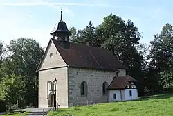
 Notre-Dame Chapel
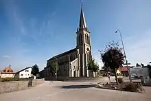
 Saint Vincent Church
 Illens Castle
References
- ↑ "Arealstatistik Standard - Gemeinden nach 4 Hauptbereichen". Federal Statistical Office. Retrieved 13 January 2019.
- ↑ "Ständige Wohnbevölkerung nach Staatsangehörigkeitskategorie Geschlecht und Gemeinde; Provisorische Jahresergebnisse; 2018". Federal Statistical Office. 9 April 2019. Retrieved 11 April 2019.
- ↑ Amtliches Gemeindeverzeichnis der Schweiz published by the Swiss Federal Statistical Office (in German) accessed 19 January 2016
- ↑ Rossens in German, French and Italian in the online Historical Dictionary of Switzerland.
- ↑ Arealstatistik Standard - Gemeindedaten nach 4 Hauptbereichen
- ↑ "Arealstatistik Land Use - Gemeinden nach 10 Klassen". www.landuse-stat.admin.ch. Swiss Federal Statistical Office. 24 November 2016. Retrieved 14 February 2018.
- 1 2 3 4 5 "Regional portraits 2019: key data of all communes". bfs.admin.ch. Swiss Federal Statistical Office. 28 March 2019. Retrieved 14 October 2019.
- ↑ "Ständige und nichtständige Wohnbevölkerung nach institutionellen Gliederungen, Geburtsort und Staatsangehörigkeit". bfs.admin.ch (in German). Swiss Federal Statistical Office - STAT-TAB. 31 December 2020. Retrieved 21 September 2021.
- ↑ "Die Raumgliederungen der Schweiz 2016" (in German, French, Italian, and English). Neuchâtel, Switzerland: Swiss Federal Statistical Office. 17 February 2016. Retrieved 14 December 2016.
- ↑ Swiss Federal Statistical Office -Arbeitsstätten und Beschäftigte nach Gemeinde, Wirtschaftssektor und Grössenklasse accessed 26 June 2019
- ↑ "Swiss inventory of cultural property of national and regional significance". A-Objects. Federal Office for Cultural Protection (BABS). 1 January 2018. Archived from the original on 28 June 2010. Retrieved 11 November 2019.
External links
- Official website (in French)
- Corpataux-Magnedens in German, French and Italian in the online Historical Dictionary of Switzerland.
- Corpataux in German, French and Italian in the online Historical Dictionary of Switzerland.
- Magnedens in German, French and Italian in the online Historical Dictionary of Switzerland.
- Farvagny in German, French and Italian in the online Historical Dictionary of Switzerland.
- Farvagny-le-Grand in German, French and Italian in the online Historical Dictionary of Switzerland.
- Farvagny-le-Petit in German, French and Italian in the online Historical Dictionary of Switzerland.
- Grenilles in German, French and Italian in the online Historical Dictionary of Switzerland.
- Posat in German, French and Italian in the online Historical Dictionary of Switzerland.
- Illens in German, French and Italian in the online Historical Dictionary of Switzerland.